


What's Happening?
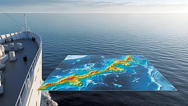
The NOAA Ship Rainier is set to embark on a mission in early April to map and characterize over 8,000 square nautical miles of federal waters off Kingman Reef and Palmyra Atoll in the Pacific Ocean. This initiative is part of the U.S. Offshore Critical
Minerals Mapping Plan, following President Trump’s Executive Order 14285, which aims to unleash America's offshore critical minerals and resources. The Rainier, a hydrographic survey ship, will conduct its first survey leg using multibeam echo sounders to map deep waters. The second leg will involve autonomous underwater vehicles from Orpheus Ocean to capture high-resolution seabed imagery and geological samples, in collaboration with the NOAA Ocean Exploration Cooperative Institute.
Why It's Important?
This mapping project is crucial for identifying potential critical mineral deposits, which are essential for various industries, including technology and renewable energy. By providing publicly accessible maps and data, NOAA aims to enhance the understanding of the deep-ocean environment and stimulate further exploration and research. The findings could lead to new opportunities for resource extraction, potentially reducing the U.S.'s reliance on foreign sources for critical minerals. This initiative aligns with broader national interests in securing supply chains for essential materials and fostering economic growth through resource development.
What's Next?
Following the completion of the survey, NOAA will analyze the collected data to assess the potential for critical mineral deposits in the surveyed areas. The results will be shared with federal agencies and stakeholders to inform future exploration and management decisions. This project may pave the way for additional surveys and research initiatives aimed at expanding the U.S.'s knowledge and utilization of offshore mineral resources. The outcomes could influence policy decisions regarding resource management and environmental protection in the Pacific region.