


What's Happening?
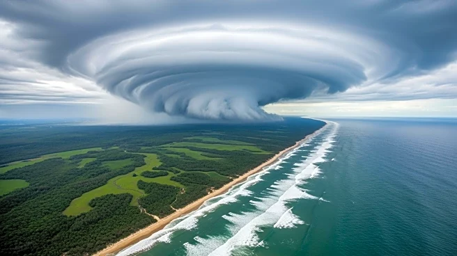
Tropical Cyclone Narelle has made multiple landfalls across northern Australia, bringing damaging winds and heavy rainfall to the region. The cyclone first intensified over the Coral Sea, reaching category 5 status before making landfall in Queensland.
It then weakened as it moved across the Northern Territory, causing significant rainfall and potential flooding. The storm is expected to re-intensify as it moves off the coast of Western Australia, potentially impacting areas along the coastline towards Perth. This event is notable for its multiple landfalls, a rare occurrence for cyclones in Australia.
Why It's Important?
The impact of Cyclone Narelle highlights the vulnerability of northern Australia to severe weather events, particularly in regions already experiencing a wet season. The cyclone's path has caused widespread disruption, with potential flooding threatening communities and infrastructure. The storm's intensity and trajectory underscore the challenges posed by climate change, as warmer sea surface temperatures contribute to the rapid intensification of such systems. The economic and social implications are significant, with potential damage to property, agriculture, and local economies.
What's Next?
As Narelle continues its path, authorities are monitoring its potential re-intensification and the threat it poses to Western Australia. Emergency services are on alert, and communities along the projected path are advised to prepare for possible evacuations and further disruptions. The Bureau of Meteorology will provide ongoing updates, and residents are urged to stay informed about weather warnings and safety advisories. The situation remains dynamic, with the potential for further developments as the cyclone progresses.