




What's Happening?
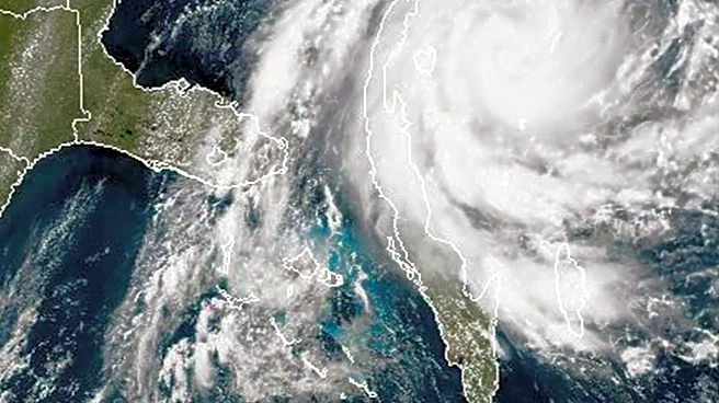
The National Hurricane Center (NHC) is currently monitoring two distinct areas of low pressure in the Atlantic Ocean for potential tropical or subtropical development. One system is located several hundred miles north-northeast of the Azores, developing
along a front. While currently non-tropical, the NHC suggests it could acquire subtropical or tropical characteristics by Saturday or early Sunday as it separates from the front. This system is projected to move east-southeast towards Portugal and northwestern Spain. The second disturbance is situated several hundred miles east-southeast of Bermuda in the central subtropical Atlantic. This weak area of low pressure is producing concentrated showers and thunderstorms, but its surface pressures remain relatively high, indicating slow development, if any. This system is expected to drift west-southwest through Sunday before turning northward early next week. Both systems currently have low chances of development, with neither exceeding a 20% chance of formation within the next 48 hours or seven days.
Why It's Important?
The monitoring of these Atlantic disturbances is crucial for U.S. coastal communities and maritime interests, even though neither currently poses an immediate threat to the United States. The Atlantic hurricane season requires constant vigilance, as even systems with low development chances can evolve rapidly. For the U.S., understanding potential storm trajectories and intensities is vital for preparedness, emergency management, and economic sectors such as shipping, tourism, and agriculture. While the system near Europe is not a direct U.S. threat, its development could influence broader atmospheric patterns that might affect future U.S.-bound systems. The disturbance east of Bermuda, though weak, is in a region that warrants close observation, as its eventual path could shift. This ongoing monitoring ensures that U.S. agencies and the public are informed, allowing for timely responses to protect lives and property should a threat emerge.
What's Next?
The National Hurricane Center will continue to issue regular updates on both areas of low pressure. Forecasters will closely track any changes in organization, intensity, and trajectory. For the system near the Azores, the focus will be on whether it detaches from the front and develops subtropical or tropical characteristics as it approaches Europe. For the disturbance east of Bermuda, the NHC will monitor for any signs of increased organization or a decrease in surface pressures, which would indicate a higher potential for tropical development. While development chances remain low for both, residents and maritime operators in the affected regions, particularly near Portugal and northwestern Spain, should stay informed about potential unsettled weather. The NHC's advisories will guide any necessary preparedness actions, though no immediate U.S. threat is anticipated.
Beyond the Headlines
The continuous monitoring of even low-probability tropical disturbances highlights the sophisticated meteorological capabilities and proactive approach of U.S. weather agencies. This vigilance is a testament to lessons learned from past hurricane seasons, emphasizing that early detection and consistent communication are paramount. Beyond the immediate weather implications, these events contribute to a broader understanding of climate patterns and the dynamics of tropical cyclone formation. The distinction between tropical and subtropical development is also significant, as it reflects different atmospheric conditions and potential impacts. This scientific rigor is essential for refining predictive models and improving long-term climate projections, which have profound implications for U.S. infrastructure planning, coastal resilience strategies, and insurance industries in an era of changing climate.