
What's Happening?
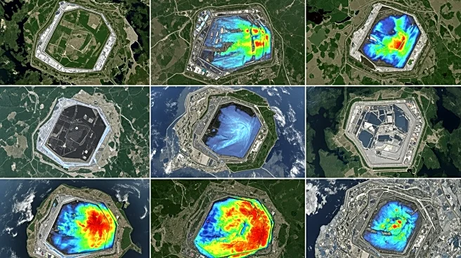
A study using GHGSat high-resolution satellite data has uncovered significant disparities in methane emissions from landfills worldwide. The research highlights that a small fraction of sites are responsible
for most emissions, revealing gaps between reported and actual emissions. The study emphasizes the need for aligning bottom-up inventories with top-down satellite data to improve emission estimates and mitigation strategies.
Why It's Important?
The findings underscore the importance of accurate methane emission monitoring for climate change mitigation. By identifying high-emitting sites, the study provides actionable insights for targeted interventions, potentially reducing global methane emissions. The use of satellite technology offers a comprehensive view of emission hotspots, aiding policymakers in developing effective environmental strategies and regulations.