
What's Happening?
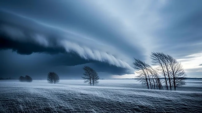
A massive cold front is sweeping across the United States, affecting regions from Texas to New York. The National Weather Service (NWS) has issued frost advisories and freeze warnings for the Southern
Plains, Midwest, Northeast, and Mid-Atlantic. Nighttime temperatures are expected to drop below freezing in some areas, posing a risk to early-season crops and sensitive vegetation. This cold surge is attributed to a polar vortex that occurred in March and April, creating conditions for cold air to move south from Canada. The coldest temperatures are expected in western and southern Wisconsin, with lows reaching 23 degrees. While some areas may not see temperatures fall below 32 degrees, frost remains a risk due to radiational cooling.
Why It's Important?
The unseasonable cold front poses significant risks to agriculture, particularly as much of the country is already in the growing season. Early-season crops and sensitive vegetation are vulnerable to damage from the freezing temperatures. This could have economic implications for farmers and the agricultural sector, potentially affecting food supply and prices. Additionally, the cold front highlights the unpredictability of weather patterns, which can have broader implications for climate-related planning and preparedness.
What's Next?
The freeze warnings are primarily in place for Friday night, with a freeze watch extending into Saturday night for states like Kentucky, Virginia, West Virginia, and Pennsylvania. After the weekend, the risk of frost or freeze conditions is expected to diminish in the Midwest and Northeast, although some areas may still experience cold nights. Meteorologists anticipate that this May will not be the coldest on record for the affected regions, but the situation underscores the need for ongoing monitoring and adaptation to changing weather patterns.