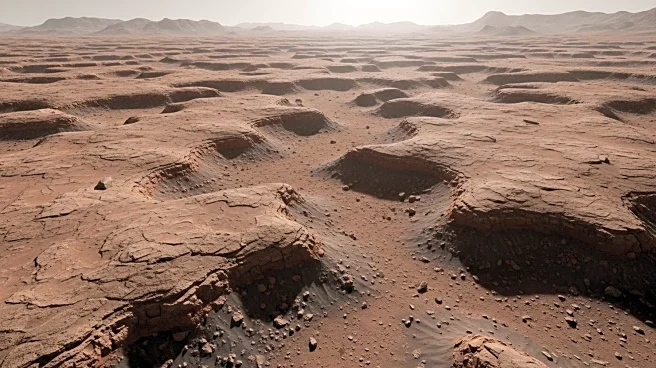

What's Happening?
NASA's Curiosity rover has captured images of a Martian landscape characterized by ridges and hollows. The rover, currently navigating this uneven terrain, is using its Left Navigation Camera to document the area. The mission team is focusing on imaging the ridges and hollows, while also conducting chemical analyses using instruments like APXS and ChemCam. The rover's activities are part of a broader effort to understand the geological history of Mars, particularly the role of water-bearing minerals in shaping the landscape.
Why It's Important?
The findings from Curiosity's exploration could provide significant insights into the past presence of water on Mars, which is crucial for understanding the planet's potential to support life. The data collected may also inform future missions, including those aimed at human exploration. Understanding the composition and structure of Martian terrain helps scientists assess the planet's habitability and geological history, which are key to planning future exploration and potential colonization efforts.
What's Next?
Curiosity will continue its exploration of the Martian surface, focusing on areas with significant geological features. The mission team plans to conduct further chemical analyses and imaging to deepen their understanding of the Martian environment. These efforts will contribute to the ongoing assessment of Mars as a potential site for future human exploration.