


What's Happening?
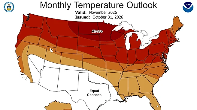
The National Weather Service (NWS) is forecasting a higher probability of above-normal temperatures and a slight chance of below-normal precipitation for northern Minnesota, including the Superior National Forest, this winter. This outlook is primarily
influenced by a very strong El Niño event developing in the Pacific Ocean. El Niño, a climate pattern characterized by warmer-than-normal water temperatures in the central and eastern Pacific, impacts the jet stream and, consequently, weather patterns across North America. Ketzel Levens, a meteorologist with the NWS in Duluth, stated that the three-month outlook from December to February indicates a 50% to 60% chance of above-normal temperatures for Minnesota’s Arrowhead region. While the term 'Super El Niño' has been used by some media, Levens clarified that the NWS categorizes such events as weak, moderate, strong, or very strong, and this particular El Niño is expected to be one of the strongest in recent decades, presenting some unprecedented forecasting challenges.
Why It's Important?
This forecast carries significant implications for northern Minnesota's economy and lifestyle, particularly for its winter tourism industry. A warmer winter with less snow could negatively impact businesses in Cook County and along the North Shore that rely on activities like snowmobiling and cross-country skiing. Many of these businesses are still recovering from financial losses incurred during the summer due to wildfire-related closures and evacuations. A less favorable winter recreation season could add another layer of economic uncertainty. Historically, El Niño winters in Minnesota have averaged 2.4 degrees Fahrenheit warmer statewide since 1950, with seasonal snowfall in the Twin Cities averaging nearly 14 inches less. While this trend doesn't always apply to the North Shore, the overall outlook suggests potential disruptions for winter-dependent sectors and recreational enthusiasts.
What's Next?
Residents and businesses in northern Minnesota should prepare for a winter that may feature more 'freeze-thaw' occurrences and periods with less snow or precipitation, according to meteorologist Ketzel Levens. While the NWS forecast indicates a strong likelihood of warmer and drier conditions, it's important to remember that forecasts are not guarantees, and other atmospheric patterns will also play a role as the season progresses. Despite the general outlook, significant snowfall events are still possible, as evidenced by past El Niño winters like the Halloween Blizzard of 1991. Local businesses, particularly those in the tourism sector, will need to adapt to potentially fluctuating winter conditions, which could include a shorter or less consistent snow season. Monitoring updated forecasts from the National Weather Service will be crucial for planning and preparedness.
Beyond the Headlines
The anticipated strong El Niño highlights the broader impact of global climate patterns on regional weather and local economies. The NWS's careful distinction between 'Super El Niño' and its internal categorization of 'very strong' underscores the scientific precision required in meteorological communication, especially when public perception can be influenced by sensationalized terms. The potential for a historically strong El Niño also brings a degree of 'unprecedented territory' to forecasting, as noted by Levens, suggesting that even with advanced models, the exact manifestations of such powerful climate events can be complex and challenging to predict with absolute certainty. This situation emphasizes the ongoing need for robust climate research and adaptive strategies for communities and industries vulnerable to climate variability.