







What's Happening?
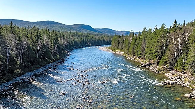
Contrary to most rivers in Maine that flow towards the Atlantic Ocean, four significant rivers in the northern part of the state—the Upper St. John, Allagash, Fish, and Aroostook—flow northward. These four rivers are integral components of the St. John River
basin, which ultimately drains into New Brunswick, Canada, and then into the Bay of Fundy. The primary reason for this unusual flow direction is the topography of northern Maine; the land in this region slopes towards the St. John River basin rather than towards the major south-flowing rivers of Maine. A distinct drainage divide separates these two systems, ensuring that water falling on the northern side flows towards the St. John, while water on the southern side flows towards rivers like the Penobscot and Kennebec, eventually reaching the Atlantic. The Allagash River exemplifies this, flowing approximately 62 miles north from Churchill Dam to join the St. John River, descending over 300 feet in the process.
Why It's Important?
This unique hydrological characteristic is important for understanding the regional geography and ecological systems of northern Maine. The northward flow influences local ecosystems, water quality, and the distribution of aquatic species, as these rivers connect to a different major watershed than most other Maine rivers. For instance, the St. John River basin's connection to New Brunswick means that environmental policies and water management practices in both the U.S. and Canada can impact these shared waterways. Furthermore, the geological forces that shaped these river systems, particularly the impact of Ice Age glaciers, provide valuable insights into the geomorphological history of the region. This natural phenomenon also has implications for recreational activities like canoeing and fishing, as the flow direction dictates navigation and the types of fish species found in these waters.
What's Next?
Understanding the northward flow of these rivers is crucial for ongoing environmental management and conservation efforts in northern Maine and the broader St. John River basin. Future considerations may include cross-border collaborations between U.S. and Canadian environmental agencies to manage water resources, monitor water quality, and protect shared ecosystems. As climate patterns shift, changes in precipitation and snowmelt could affect the volume and flow rates of these rivers, potentially impacting their ecological balance and the communities that rely on them. Continued geological and hydrological studies could further refine our understanding of how these unique river systems evolved and how they might respond to future environmental changes. This knowledge is vital for sustainable resource management and preserving the natural heritage of the region.
Beyond the Headlines
The phenomenon of rivers flowing north in Maine offers a compelling illustration of how geological history profoundly shapes contemporary landscapes and ecosystems. The massive ice sheets of the Ice Age were not merely destructive forces but also sculptors that reshaped mountains, carved valleys, and fundamentally altered drainage patterns, creating the very landscape through which these rivers flow today. This geological legacy underscores the dynamic nature of Earth's surface and how ancient events continue to influence modern environmental characteristics. From a broader perspective, these rivers highlight the interconnectedness of natural systems across political boundaries, emphasizing that water does not adhere to human-drawn lines. This necessitates a holistic, transboundary approach to environmental stewardship, recognizing that the health of these rivers impacts both Maine and New Brunswick, fostering a shared responsibility for their preservation.