


What's Happening?
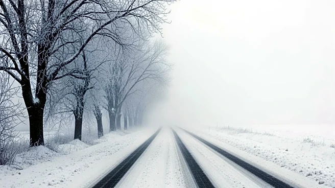
The National Weather Service (NWS) has issued blizzard warnings across parts of the Upper Midwest, including Minnesota, South Dakota, and Wisconsin, as a powerful winter storm is set to bring extreme snowfall and strong winds. The storm is expected to make
travel 'very difficult or impossible' from late Saturday night through Sunday. Forecasts predict snowfall totals of 12 to 18 inches across central Minnesota and western Wisconsin, with some areas potentially receiving up to two feet. Snowfall rates could reach 2 to 2.5 inches per hour. In addition to the snow, a wintry mix of rain, freezing rain, and sleet is expected in southern Minnesota, transitioning back to snow by Sunday morning. Winds are anticipated to increase, with gusts up to 55 mph, leading to blowing snow and reduced visibility. Avalanche danger is also heightened in Montana's high country due to heavy snow and strong winds.
Why It's Important?
The severe weather conditions pose significant risks to public safety and transportation in the affected regions. The blizzard could disrupt travel, leading to road closures and delays, impacting both personal and commercial transportation. The heightened avalanche risk in Montana's mountainous areas further underscores the potential dangers for outdoor enthusiasts and residents. The storm's impact on infrastructure and emergency services could strain local resources, necessitating coordinated responses from state and local agencies. Additionally, the storm highlights the ongoing challenges posed by extreme weather events, which can have broader implications for regional economies and community resilience.
What's Next?
As the storm progresses, residents in the affected areas are advised to limit travel to emergencies only and to prepare for potential power outages and supply shortages. Local authorities may implement road closures and emergency measures to ensure public safety. The NWS will continue to monitor the storm's development and update warnings as necessary. Communities in the storm's path should stay informed through local news and weather updates to make informed decisions about safety and travel. The response from emergency services and local governments will be crucial in mitigating the storm's impact and ensuring the safety of residents.