
What's Happening?
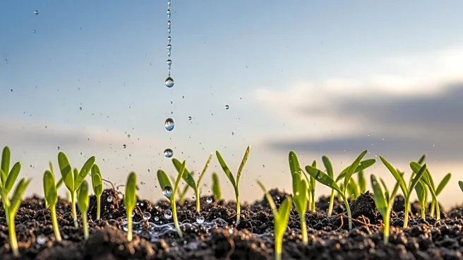
A recent study from the University of California San Diego, published in Nature Sustainability, has identified a significant factor affecting global crop stability: the origin of rainfall. The research,
led by Yan Jiang, tracks atmospheric moisture back to its source, whether from oceans or land surfaces like soil and forests. The study highlights that the ratio of ocean to land moisture significantly influences regional drought risk and agricultural productivity. Using nearly 20 years of satellite data, the researchers found that when more than one-third of precipitation originates from land, croplands become more susceptible to drought, leading to declines in soil moisture and crop yields. This discovery provides a new method for identifying regions at higher risk and planning water and crop management strategies more effectively.
Why It's Important?
The findings of this study have profound implications for global agriculture, particularly in regions like the U.S. Midwest and East Africa, which are heavily reliant on land-sourced moisture. In the Midwest, increased drought frequency and intensity could disrupt one of the world's most productive agricultural zones, affecting global grain markets. In East Africa, the rapid expansion of croplands and deforestation threaten the moisture sources essential for sustaining rainfall, posing a risk to local food security. The study underscores the importance of soil moisture conservation, irrigation efficiency, and strategic land management to mitigate the impacts of drought and ensure agricultural sustainability.
What's Next?
The study suggests that regions dependent on land-originating moisture need to adopt smarter land management practices, such as conserving forests and restoring vegetation, to protect rainfall and sustain agricultural growth. Policymakers and farmers are encouraged to use this new framework to link land use decisions with rainfall patterns and agricultural planning, enhancing drought resilience. The research also introduces a satellite-based mapping method to guide investments in irrigation, soil water retention, and forest conservation, which could stabilize rainfall and support long-term agricultural productivity.