


What's Happening?
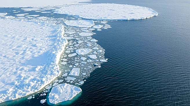
NASA's Terra satellite captured images of the Bering Sea off Alaska's coast, showing the seasonal transition as summer approaches. The images, taken on June 3, 2026, reveal sea ice breaking into small fragments and swirling in the ocean, while rivers
swollen with snowmelt carry sediment and organic material to the sea. The false-color images highlight features such as the tundra and marsh vegetation, which appear green, and ice-free rivers and lakes, which are dark blue. The images also show Saint Lawrence and Nunivak islands, which have volcanic origins and are among the largest islands in the U.S.
Why It's Important?
The seasonal thaw in the Bering Sea is a significant environmental event, as it affects local ecosystems and the broader climate system. The melting sea ice and increased sediment flow can impact marine life and coastal communities. Understanding these changes is crucial for scientists studying climate change and its effects on the Arctic region. The data collected by NASA's satellites provide valuable insights into these processes, helping to inform environmental policies and conservation efforts.