


What's Happening?
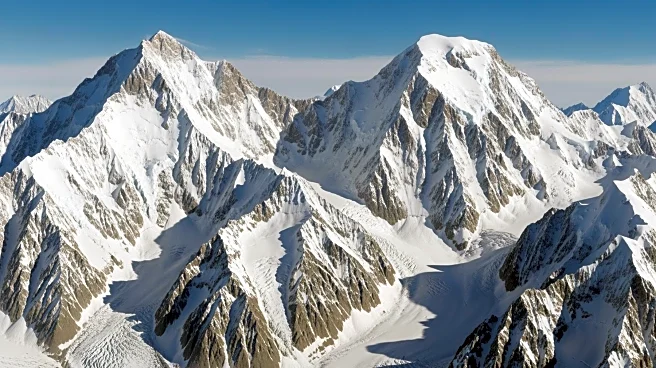
A Copernicus Sentinel-2 satellite has captured a striking image of Greenland's mountainous landscape, highlighting the region's role in shaping local climate patterns. The image, taken from low Earth orbit, shows the Helheim Glacier and surrounding mountains,
which influence the movement of the Greenland ice sheet by directing ice and meltwater toward the ocean. The Sentinel-2 mission, part of the European Union's Copernicus program, aims to monitor environmental changes using high-resolution imagery.
Why It's Important?
The imagery from Sentinel-2 provides critical insights into how Greenland's topography affects ice flow and contributes to global sea-level rise. Understanding these dynamics is essential for predicting future changes in the ice sheet and their potential impact on coastal communities worldwide. The data supports climate research and helps policymakers develop strategies to mitigate the effects of climate change. The collaboration between the European Union and the European Space Agency underscores the importance of international efforts in environmental monitoring.
Beyond the Headlines
The Sentinel-2 images not only offer a visual representation of Greenland's icy terrain but also serve as a tool for scientists to study the interactions between ice, climate, and topography. The mission's ability to track changes over time provides a valuable resource for assessing the long-term impacts of climate change on polar regions. This information is crucial for understanding the broader implications of ice loss and developing adaptive measures to address the challenges posed by a warming planet.