


What's Happening?
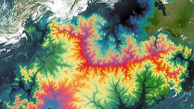
NASA has integrated the TiTiler-CMR API into its Worldview application, enhancing the ability to customize high-resolution satellite imagery for various research and operational needs. This tool allows users to dynamically generate multispectral visualizations
by assigning specific spectral bands to different color channels, enabling the analysis of vegetation health, drought impacts, and land use changes. The TiTiler-CMR, released in 2025, is an open-source library developed to streamline workflows by providing on-demand map tile layers without the need for data pre-processing. This integration supports NASA's data-to-action initiatives by making it easier for researchers to access and utilize complex datasets.
Why It's Important?
The integration of TiTiler-CMR into Worldview represents a significant advancement in how researchers can interact with and interpret satellite data. By allowing for the customization of imagery, scientists can gain more precise insights into environmental conditions and changes, which is crucial for monitoring climate change, natural disasters, and agricultural productivity. This tool reduces the time and resources needed to process data, thereby accelerating the pace of scientific discovery and decision-making. The ability to visualize data in new ways can lead to more informed policy decisions and better resource management strategies.
What's Next?
Future developments in the Worldview application will include the ability to generate true-color composites for the Arctic region, providing access to high-resolution imagery that was previously unavailable. This expansion will further enhance the capabilities of researchers studying polar environments and contribute to a more comprehensive understanding of global climate dynamics. As NASA continues to refine and expand its data visualization tools, the potential for new applications and insights will grow, benefiting a wide range of scientific and operational fields.