
What's Happening?
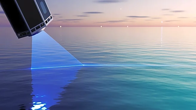
NASA's ICESat-2 ATLAS instrument is providing precise bathymetric data for coastal and marine applications. The lidar instrument sends out 10,000 pulses of light towards Earth, offering shallow, near-shore
bathymetric data for various uses, including marine navigation and habitat research. ATLAS can reach depths of up to 40 meters in regions with adequate water clarity. NASA's Applied Remote Sensing Training program is offering a two-part live online training to expand users' knowledge of the ICESat-2 mission and how to access and analyze bathymetry data.
Why It's Important?
The data provided by ICESat-2 ATLAS is crucial for safe navigation and effective management of coastal and marine environments. Accurate bathymetric data supports various applications, from shipping to environmental research, enhancing safety and sustainability in marine operations. The training program aims to equip remote sensing scientists and geospatial analysts with the skills to utilize this data effectively, potentially leading to advancements in marine science and technology.
What's Next?
The upcoming training sessions will provide participants with the opportunity to learn how to access and analyze ICESat-2 bathymetry data. This could lead to increased utilization of the data in various sectors, driving innovation and improving marine management practices. As more organizations adopt satellite-derived bathymetry, there may be further developments in technology and applications.
Beyond the Headlines
The use of satellite-derived bathymetry data raises questions about the long-term impact on marine ecosystems and the ethical considerations of data usage. As technology advances, there may be discussions on balancing technological benefits with environmental protection.