





What's Happening?
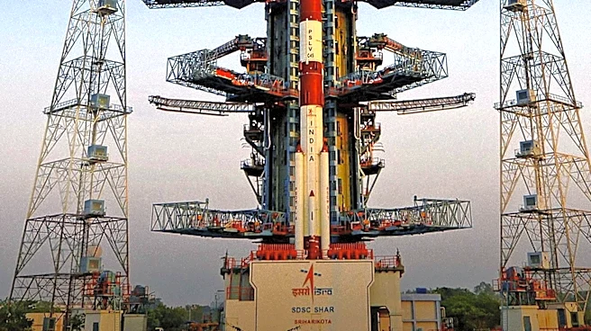
The NASA-ISRO Synthetic Aperture Radar (NISAR) mission, a joint effort between NASA and the Indian Space Research Organisation (ISRO), is an international Earth-observing satellite system. This mission is designed to provide systematic, high-resolution
radar measurements of global surface processes. Unlike optical sensors, NISAR utilizes active microwave radar, transmitting coherent microwave pulses and recording backscatter amplitude and phase. This capability allows for day-and-night monitoring through cloud cover, fog, and smoke. NISAR is the first spaceborne radar to combine dual-frequency synthetic aperture radar, integrating L-band (1.25 GHz; 24 cm wavelength) and S-band (3.2 GHz; 9.4 cm wavelength) on a single spacecraft. NASA's Jet Propulsion Laboratory (JPL) contributes the L-band SAR instrument, a 12-meter deployable wire-mesh reflector antenna, and global data archiving infrastructure. ISRO's Space Applications Centre (SAC) and URSC provide the S-band SAR instrument, the spacecraft bus, and launch operations. The satellite operates in a Sun-synchronous circular polar orbit at 747 km altitude, with a 12-day exact repeat cycle, sampling global land and ice masses.
Why It's Important?
The NISAR mission holds significant importance for various Earth science domains and analytical workflows in the U.S. and globally. Its ability to measure millimeter-scale surface deformation, ecosystem biomass, and ice-sheet dynamics every 12 days provides critical data for understanding and addressing environmental challenges. For solid Earth geodesy, geophysics laboratories can map strain accumulation on tectonic faults, quantify co-seismic slip, and monitor volcanic inflation, aiding in hazard prediction and mitigation. Hydrologists and environmental agencies can monitor groundwater and land subsidence, crucial for managing water resources and urban stability. Glaciologists will track ice stream velocities and calving dynamics in polar regions, contributing to climate change research. Forest researchers can map aboveground woody biomass, helping monitor deforestation and carbon inventories. The open-access data policy ensures that this valuable information is freely available to the public, academic researchers, and commercial organizations, fostering widespread scientific advancement and practical applications.
What's Next?
NISAR data products will be openly distributed, with global L-band data available via the Alaska Satellite Facility (ASF) DAAC through NASA Earthdata, and S-band and Indian regional datasets accessible via ISRO’s Bhoonidhi portal. This open data policy will facilitate widespread research and application development. Researchers will integrate NISAR data into existing workflows, such as Google Earth Engine, or process it locally with tools like Python Rasterio. The mission's continuous monitoring capabilities will provide ongoing updates on Earth's dynamic processes, leading to improved models and predictions for climate change, natural hazards, and resource management. The insights gained from NISAR are expected to inform policy decisions related to environmental protection, disaster preparedness, and sustainable development, both in the U.S. and internationally.
Beyond the Headlines
The NISAR mission represents a significant leap in remote sensing technology, moving beyond traditional optical imaging to provide detailed, all-weather observations. The dual-frequency SAR system offers complementary insights: L-band penetrates vegetation and dry soil for biomass quantification and fault displacement, while S-band interacts with smaller vegetative structures for agricultural assessment and soil moisture mapping. This distinction highlights the complexity of Earth's surface and the need for multi-faceted observational tools. The mission also underscores the growing importance of international collaboration in addressing global scientific challenges, with NASA and ISRO pooling resources and expertise. The sheer volume of data generated—85 to 100 terabytes daily—also emphasizes the increasing reliance on advanced computing and data infrastructure for scientific research, pushing the boundaries of data management and analysis.