








What's Happening?
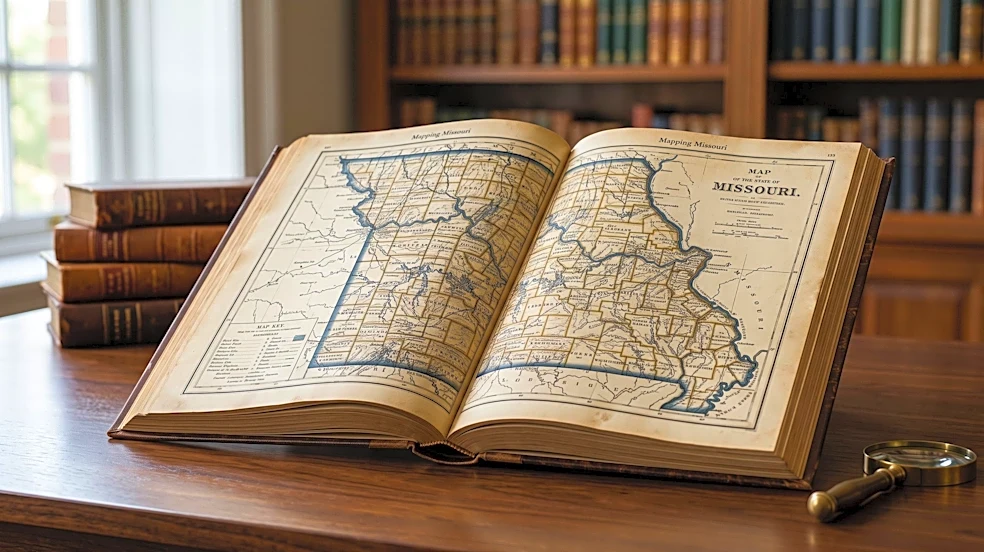
Andrew W. Hahn has released his new book, 'Mapping Missouri,' which delves into the history of the state through a collection of 40 maps. This book serves as a sequel to his previous work, 'Mapping St. Louis.' Hahn, who is also the executive director
of the Campbell House Museum in downtown St. Louis, undertook the challenge of compressing hundreds of years of Missouri's history into 164 pages, utilizing maps that range from prehistoric geological surveys to contemporary data like the 2020 Census and tornado activity. The maps illustrate the state's evolution from tribal lands to its time under French and Spanish rule, and finally as part of the United States. Hahn notes that maps, while serving as wayfinding tools, also inherently tell political stories about human movement and governmental changes over time.
Why It's Important?
Andrew W. Hahn's 'Mapping Missouri' offers a unique and accessible approach to understanding the state's complex history and development. By using maps as a primary narrative device, the book provides a visual and geographical context for historical events, political shifts, and demographic changes. This method can make history more engaging and comprehensible for a broader audience, including students and general readers. The book's exploration of Missouri's 114 counties, a number significantly higher than most other states, highlights the historical reasons behind such administrative divisions, such as the need for accessible county courthouses in earlier times. This insight into local governance and its historical roots is crucial for understanding the current political and social landscape of Missouri and other states with similar historical development. The success of Hahn's previous 'Mapping St. Louis' suggests a strong public interest in this cartographic storytelling approach.
What's Next?
The release of 'Mapping Missouri' is expected to generate interest among history enthusiasts, educators, and residents of Missouri, potentially leading to increased engagement with the state's historical narratives. The book's format, which proved successful with 'Mapping St. Louis,' may inspire similar cartographic histories for other U.S. states or regions, as publisher Reedy Press is already launching a series of similarly formatted books for other cities. This trend could lead to a broader appreciation for the role of maps in historical interpretation and education. For Missouri, the book could spark discussions about the state's past, its unique geographical and political structures, and even contemporary issues like the potential for local government consolidation, a topic Hahn considered during his research. The book's ability to connect historical maps with current events, such as tornado activity, also underscores the enduring relevance of cartography in understanding ongoing challenges.
Beyond the Headlines
Beyond its historical and educational value, 'Mapping Missouri' subtly touches upon the deeper implications of cartography as a reflection of human endeavor and societal organization. Hahn's observation that maps are inherently 'political' because they document how people and governments shape territories speaks to the power dynamics embedded in geographical representations. The book's focus on the evolution of Missouri's boundaries and administrative divisions, from tribal lands to numerous counties, illustrates how human decisions, rather than just natural features, define our understanding of place. This perspective encourages readers to critically examine how maps are created and what stories they tell, or omit. The discussion about the historical reasons for Missouri's many counties and the contemporary debate about consolidation also highlights the tension between historical legacy and modern efficiency in governance, a challenge faced by many regions across the U.S. The book serves as a reminder that maps are not just static images but dynamic narratives of human interaction with the land.