


What is the story about?
What's Happening?
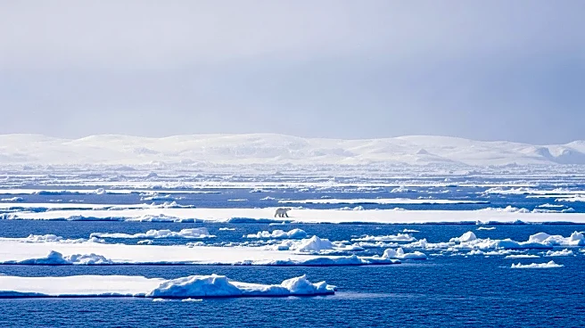
NASA and the National Snow and Ice Data Center have reported that Arctic sea ice reached its annual minimum on September 10, tying with 2008 for the 10th-lowest extent on record. The total sea ice coverage was 1.78 million square miles. This continues a trend of declining sea ice extent observed since 1978, attributed to rising global temperatures. In contrast, Antarctic sea ice is nearing its annual maximum but remains lower than average compared to pre-2016 levels. The data is part of a continuous record maintained by NASA and NOAA, which began with the Nimbus-7 satellite in 1978.
Why It's Important?
The decline in Arctic sea ice is a significant indicator of climate change, affecting global weather patterns, sea levels, and ecosystems. The reduction in ice coverage impacts indigenous communities, wildlife, and global shipping routes. Understanding these changes is crucial for developing strategies to mitigate climate change effects. The continuous monitoring of sea ice by NASA and NOAA provides valuable data for researchers and policymakers to assess the long-term impacts of global warming and to inform climate action plans.
What's Next?
Scientists will continue to monitor sea ice levels in both the Arctic and Antarctic to determine if current trends persist. The data collected will be used to refine climate models and improve predictions of future changes in sea ice extent. Ongoing research will focus on understanding the complex interactions between sea ice, ocean currents, and atmospheric conditions, which are critical for predicting the impacts of climate change on global systems.