



What's Happening?
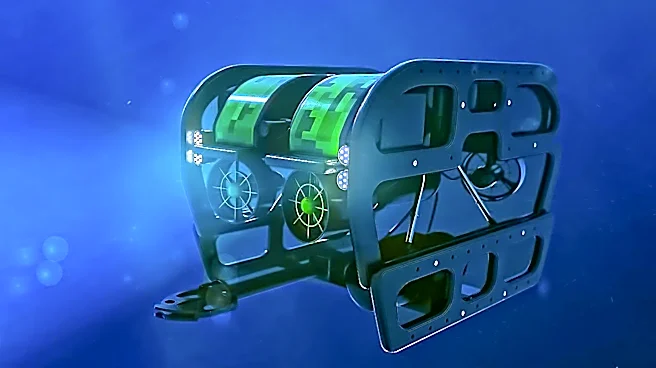
The National Oceanic and Atmospheric Administration (NOAA) Fisheries has successfully deployed two long-range autonomous underwater vehicles (LRAUVs), named Stella and Polaris, for extensive seafloor imaging missions. These 250-pound, 9-foot-long torpedo-shaped
drones, owned by the Woods Hole Oceanographic Institution and developed by the Monterey Bay Aquarium Research Institute, covered over 230 miles of seafloor and captured more than 68,000 photographs in six days with a minimal two-person crew. A key innovation in their operation is the ability to land on the seabed and enter a sleep mode during adverse weather conditions, conserving battery life and awaiting safe recovery. This capability allows the drones to operate in conditions, such as 20 to 30-foot seas, that would typically force traditional survey ships back to port. The LRAUVs are designed for endurance, using a unique method of steering by shifting an internal battery pack to adjust buoyancy and tilt, combining the efficiency of a glider with the power of a propeller-driven vehicle. They are equipped with stereo cameras, CTD instruments, and optical sensors to collect data on water quality, temperature, salinity, dissolved oxygen, currents, and marine life.
Why It's Important?
The deployment of these advanced LRAUVs marks a significant shift in oceanographic research and fishery management, offering a more cost-effective and resilient alternative to traditional methods. The ability to conduct surveys in challenging weather conditions without requiring large, expensive research vessels will substantially reduce operational costs and expand the scope of data collection. This is particularly crucial for the U.S. sea scallop fishery, which was valued at $360 million in 2023, making it the largest wild scallop fishery globally. The detailed seafloor images and environmental data collected by Stella and Polaris directly inform abundance estimates, which in turn dictate fishing quotas and access areas for commercial fleets. More accurate and consistent data collection, even in adverse conditions, ensures better-informed management decisions, promoting sustainable fishing practices and economic stability for the industry. Furthermore, these drones can operate safely within offshore wind farms, providing critical data in areas inaccessible to larger vessels, which is vital for understanding the environmental impact and co-existence of renewable energy infrastructure with marine ecosystems.
What's Next?
NOAA expects to acquire its own LRAUVs next year, built by Saab, which has licensed the MBARI design for the U.S. market. This acquisition will further integrate this technology into NOAA's operational capabilities, expanding its applications beyond scallop surveys. Future missions for the Saab vehicles are anticipated to include plankton studies, tracking whale foraging using passive acoustics, active acoustics for fish population assessments, and environmental DNA sampling. The New England Fishery Management Council’s Scallop Advisory Panel and Plan Development Team are scheduled to meet on September 9 to review the 2026 survey results from Stella and Polaris. This review will be instrumental in shaping the specifications for the 2027 and 2028 fishing years, directly impacting the commercial scallop fleet. The continued development and deployment of these autonomous systems are expected to lead to more comprehensive and efficient monitoring of marine environments, supporting a broader range of scientific and management objectives.
Beyond the Headlines
The innovative 'sleep on the seafloor' capability of these LRAUVs represents a paradigm shift in autonomous underwater vehicle design, addressing a long-standing challenge of operating in unpredictable marine environments. This approach minimizes risks associated with surface recovery in rough seas and extends mission durations by conserving energy. The success of Stella and Polaris highlights a broader trend towards smaller, more agile, and autonomous platforms for environmental monitoring, reducing reliance on human-crewed vessels and expanding data collection into previously inaccessible or cost-prohibitive areas. This technological advancement has implications beyond fisheries, potentially benefiting deep-sea exploration, marine conservation, and even defense applications. The ability to collect high-resolution data on marine ecosystems with greater frequency and in diverse conditions will enhance our understanding of ocean health, biodiversity, and the impacts of climate change, fostering more adaptive and effective management strategies for critical marine resources.