


What's Happening?
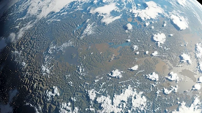
NASA's Earth Observatory has released its April 2026 satellite image puzzle, inviting the public to identify the location depicted in the image. This monthly challenge encourages participants to analyze satellite imagery and submit their guesses along
with any interesting details they can deduce about the location, such as the satellite and instrument used, spectral bands, or geological features. The initiative aims to engage the public in Earth science and satellite technology, offering 'puzzler bragging rights' as a reward for correct or insightful submissions. The answer and a detailed explanation will be posted a week after the challenge, highlighting the first correct guess and other notable responses.
Why It's Important?
This initiative by NASA serves to increase public engagement with Earth science and satellite technology, fostering a greater understanding of how these tools are used to monitor and study our planet. By involving the public in such challenges, NASA not only educates but also inspires interest in scientific inquiry and technological advancements. This can lead to increased public support for space and Earth science programs, potentially influencing future funding and policy decisions. Additionally, it provides an opportunity for individuals to contribute to scientific discussions, enhancing community involvement in scientific endeavors.
What's Next?
Participants have a week to submit their responses to the April 2026 satellite image puzzle. Following this period, NASA will reveal the correct location and provide a detailed explanation of the image. This will include insights into the satellite technology used and the significance of the location. The announcement will also recognize the first correct guess and highlight other interesting submissions, encouraging continued public participation in future challenges.