




What's Happening?
Researchers from the National University of Singapore (NUS) College of Design and Engineering (CDE) and Tsinghua University School of Architecture have developed a deep learning framework that identifies significant gaps in official U.S. flood hazard
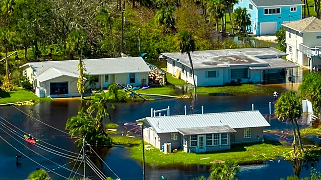
maps. This AI-powered model, detailed in Nature Communications, has generated a comprehensive 30-meter flood hazard map for the contiguous United States. The findings indicate that approximately 11 million people and 4.1 million buildings may be located in flood-prone areas that are not currently recognized by official flood maps. The framework was trained using existing official flood records and terrain data, allowing it to learn patterns associated with flood-prone regions and apply this understanding to areas with incomplete or absent mapping. This new model not only extends the boundaries of underestimated flood regions but also provides credible risk assessments for areas entirely lacking official maps.
Why It's Important?
The revelation that millions of Americans and their properties are outside official flood risk zones has profound implications for disaster preparedness, insurance, and urban planning across the U.S. Official flood maps are crucial for informing these decisions, and their inaccuracies mean that many communities are unaware of the true risks they face, hindering their ability to prepare for future floods. The study also highlights that these mapping gaps disproportionately affect socially vulnerable populations, including the elderly and children, raising concerns about equitable resource allocation and risk communication. This oversight could lead to inadequate infrastructure development, insufficient emergency response planning, and a lack of appropriate insurance coverage, leaving individuals and communities exposed to significant financial and personal losses when floods occur.
What's Next?
The researchers emphasize that their AI-generated maps are not intended to replace official regulatory flood maps but rather to serve as a public guide. The immediate next step involves leveraging this technology to highlight overlooked risks and support more targeted future mapping and adaptation efforts. This could lead to a re-evaluation of existing flood zones by federal and state agencies, potentially expanding the areas designated as high-risk. Such changes would necessitate updates to building codes, land-use policies, and insurance requirements in newly identified flood-prone regions. Furthermore, the findings could prompt increased investment in flood resilience infrastructure and more focused public awareness campaigns, particularly in vulnerable communities that have been historically under-mapped. The long-term goal is to integrate AI-driven insights into official planning processes to create more accurate and comprehensive flood risk assessments nationwide.
Beyond the Headlines
The deployment of AI in identifying previously unrecognized flood risks underscores a broader shift towards data-driven approaches in environmental management and disaster mitigation. This technology offers a scalable and cost-effective complement to traditional, often time-intensive, flood mapping methods. The study's ability to prioritize hydrologically consistent patterns over historical errors, even when trained on noisy data, demonstrates the potential of AI to overcome limitations in existing datasets. This development could foster greater public trust in scientific assessments of climate-related hazards and encourage a more proactive stance on climate adaptation. Ethically, it raises questions about the responsibility of government agencies to incorporate advanced technologies to protect citizens, especially those in vulnerable communities, from environmental threats. The success of this framework could also pave the way for AI applications in mapping other natural hazards, enhancing overall national resilience.