


What's Happening?
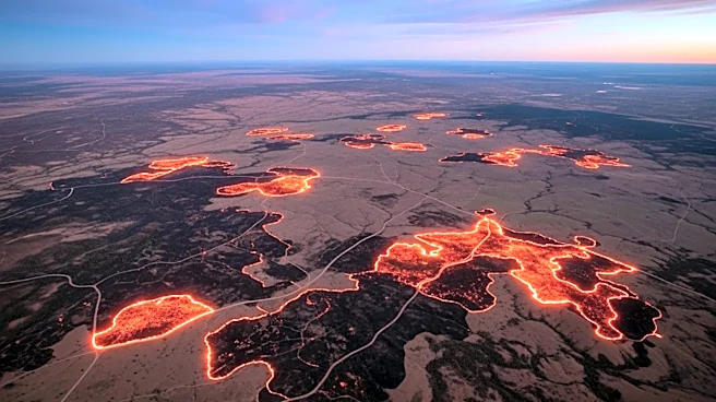
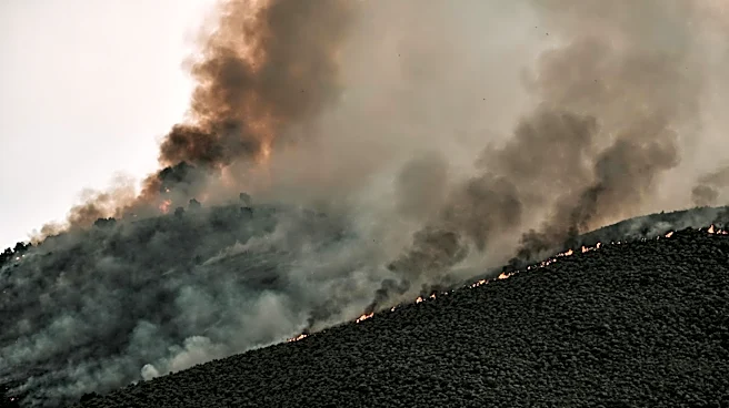
NASA's Aqua satellite has captured images of smoke and fires in Australia's Northern Territory, specifically in the Top End and Arnhem Land regions. These fires, observed on May 28, 2026, are part of a pattern of prescribed burns conducted by land managers.
The practice involves intentionally setting fires to manage the landscape, creating firebreaks, and reducing fuel loads early in the dry season. This method aims to prevent more destructive and emissions-intensive fires later in the season. The prescribed burns are a combination of Indigenous land management practices and modern technologies, forming part of large-scale programs like the West Arnhem Land Fire Abatement project. Satellite observations suggest these efforts are effective in shifting fire activity to earlier in the dry season, reducing high-intensity fires and emissions.
Why It's Important?
The use of prescribed burns in Australia's Northern Territory is significant for several reasons. It represents a successful integration of traditional Indigenous practices with modern technology to manage fire-prone landscapes. This approach not only helps in reducing the intensity and frequency of wildfires but also minimizes the environmental impact by lowering emissions. The strategy is crucial for maintaining the ecological balance in tropical savanna ecosystems, which are adapted to fire. Additionally, the success of these programs could serve as a model for other regions facing similar wildfire challenges, potentially influencing global fire management policies and practices.