

What's Happening?
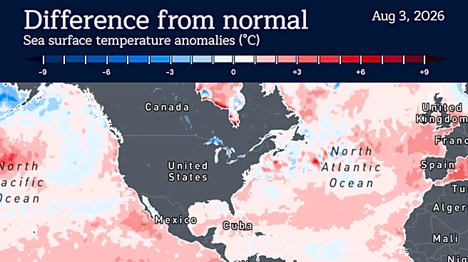
A powerful El Niño is developing, with scientists predicting it could be one of the strongest on record. According to Berkeley Earth, there is a 90% chance that this El Niño will push tropical Pacific temperatures to unprecedented levels, potentially
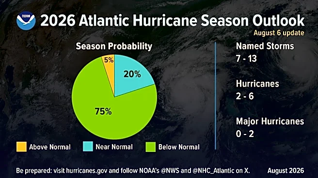
leading to higher global temperatures and extreme weather. The phenomenon, which officially formed in June, is expected to bring wetter conditions to the southern U.S., milder temperatures in the north, and a quieter Atlantic hurricane season. The World Meteorological Organization anticipates El Niño's effects to peak in the winter, with significant impacts on U.S. weather patterns.
Why It's Important?
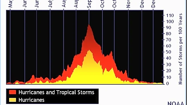
The development of a strong El Niño has far-reaching implications for the U.S., affecting weather patterns, agriculture, and disaster preparedness. Wetter conditions in the South could alleviate droughts but also increase the risk of flooding. Milder northern temperatures may impact winter sports and energy consumption. The potential reduction in hurricane activity could provide relief to coastal regions. However, the increased likelihood of extreme weather events necessitates preparedness measures across various sectors, including infrastructure, agriculture, and emergency services.
What's Next?
As El Niño progresses, meteorologists and climate scientists will closely monitor its development and provide updated forecasts. Government agencies and local authorities will need to prepare for potential weather-related challenges, such as flooding, drought, and temperature fluctuations. Public awareness campaigns may be launched to inform communities about safety measures and resource management. The agricultural sector will need to adapt to changing precipitation patterns to mitigate potential crop losses.