


What's Happening?
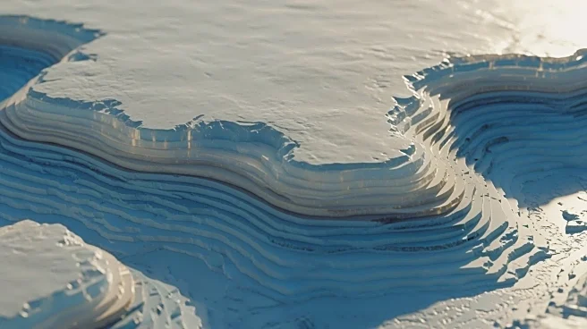
Scientists have created the most detailed map of Antarctica's hidden landscape beneath miles of ice, revealing thousands of previously unknown features. This map, developed through satellite observations and physics modeling, identifies tens of thousands of hills
and ridges, clarifying previously fuzzy images of buried mountain ranges and canyons. The study, published in Science, highlights a deep channel in the Maud Subglacial Basin, measuring around 50 meters in depth and stretching 400 kilometers in length. This advancement fills gaps left by previous radar surveys, offering a clearer picture of Antarctica's subglacial topography.
Why It's Important?
Understanding Antarctica's hidden terrain is crucial as these formations control glacier flow and retreat rates, impacting global sea levels. Melting Antarctic ice contributes to rising oceans, threatening coastal populations, drinking water supplies, and infrastructure. Improved models from this research help predict future environmental conditions, aiding in planning and mitigation efforts. The study addresses one of the largest uncertainties in projecting future climate scenarios, emphasizing the need for accurate data in environmental planning.