


What's Happening?
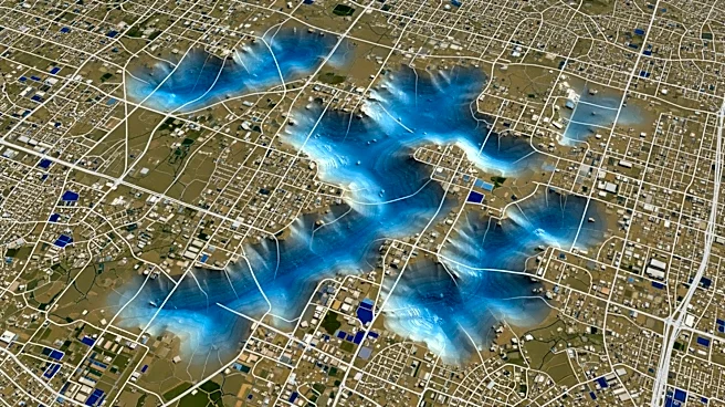
NASA's Nisar satellite is providing real-time data on Mexico City's subsidence, revealing that some areas are sinking by more than 2cm a month. This powerful radar system can detect minute changes in Earth's surface, offering insights into the city's
ongoing descent due to groundwater extraction. The satellite's capabilities extend beyond Mexico City, with potential applications in monitoring volcanoes, earthquakes, landslides, and the climate crisis. The data highlights the urgent need for sustainable water management practices to address the city's subsidence and its impact on infrastructure.
Why It's Important?
The subsidence of Mexico City poses significant challenges to its infrastructure, including roads, buildings, and water systems. The data provided by NASA's Nisar satellite is crucial for understanding the extent of the problem and informing policy decisions aimed at mitigating the impact. The insights gained from this technology can also be applied to other regions facing similar challenges, offering a valuable tool for global environmental monitoring. Addressing the root causes of subsidence, such as unsustainable groundwater extraction, is essential for ensuring the long-term resilience of urban areas.