

What's Happening?
The Atlantic Ocean has experienced its first September without a hurricane in over three decades, a phenomenon attributed to a super El Niño event. This marks only the fourth time since 1950 that September has passed without a hurricane in the Atlantic,
with previous occurrences in 1994, 1972, and 1962. While three tropical storms did form last month, none reached hurricane intensity. Tropical Storm Fay, the closest to hurricane strength, fell short by 4 mph, though a re-evaluation by the National Hurricane Center could potentially upgrade it. Typically, September is the peak month for hurricane activity, averaging two to three hurricane formations. This season's unusual calm has already set a record for the longest wait for the first hurricane to materialize, raising the rare possibility of an entire Atlantic season without hurricanes.
Why It's Important?
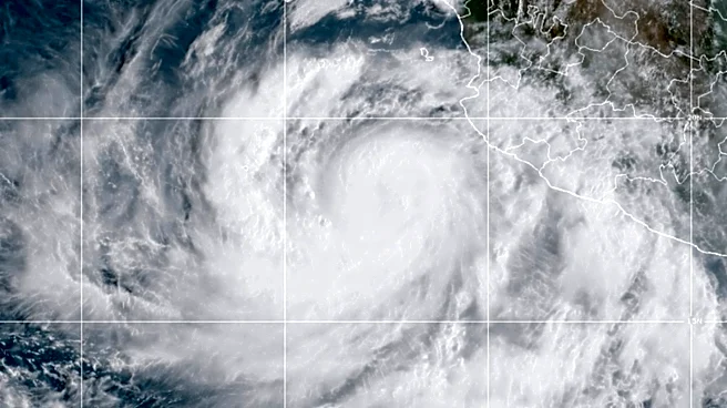
The absence of hurricanes in the Atlantic during September, a historically active month, has significant implications for coastal communities, disaster preparedness, and economic sectors reliant on weather stability. The strong El Niño-fueled wind shear has acted as a 'tropical-system kryptonite,' suppressing storm development despite warm ocean temperatures. This phenomenon shifts the focus of tropical activity to the eastern and central Pacific, which has seen a hyperactive hurricane season, including three Category 5 hurricanes. For the U.S., particularly the Gulf and Southeast coasts, a hurricane-free Atlantic September reduces immediate threats of major storm damage, but it also highlights the unpredictable nature of climate patterns and the potential for late-season storms to form closer to land. The economic impact includes reduced insurance claims, less disruption to shipping and offshore energy operations, but also a potential false sense of security for the remainder of the season.
What's Next?
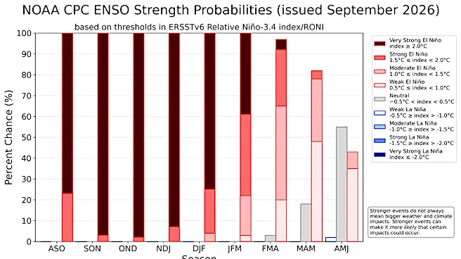
Despite the quiet September, the Atlantic hurricane season still has two months remaining, with October typically averaging one hurricane formation. The deeper into October, the greater the odds of the season ending without a hurricane. However, late-season storms tend to form closer to the United States, particularly in the Gulf, Caribbean, and off the Southeast coast, increasing their potential to impact land. While the Caribbean is currently under the influence of El Niño's shear, other areas could still see development. The ongoing El Niño is predicted to be one of the strongest ever, suggesting its influence on weather patterns will continue. Communities and weather agencies will remain vigilant, as even tropical storms, as demonstrated by Arthur and Edouard this year, can cause significant flash flooding and require water rescues, underscoring that impactful weather events are not exclusive to hurricane-strength systems.
Beyond the Headlines
The unprecedented hurricane-free September in the Atlantic, driven by El Niño, offers a stark reminder of the complex interplay between global climate phenomena and regional weather patterns. While seemingly beneficial for the Atlantic coast, this shift in storm activity to the Pacific underscores the interconnectedness of Earth's climate systems. It also raises questions about the long-term predictability of hurricane seasons in a warming world, where climate change is making tropical systems wetter and potentially more destructive, even if less frequent in certain basins. The event provides valuable data for climate scientists to refine models and improve forecasting, but it also challenges public perception of hurricane risk, potentially leading to complacency in future seasons. This highlights the need for continuous education and preparedness, regardless of short-term weather anomalies.