







What's Happening?
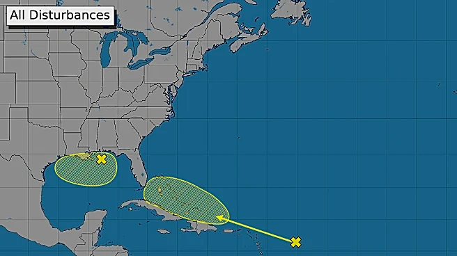
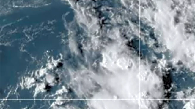
Forecasters are closely monitoring a strong tropical wave that has developed over the northern Gulf of Mexico, south of the Florida Panhandle and Mississippi. Satellite imagery and wind data from Sunday indicate that the system has become more organized
since Saturday, with deep convection forming near and just south of a broad circulation. The National Hurricane Center (NHC) reports that atmospheric conditions in the northern Gulf, characterized by low wind shear, are conducive to further development over the next couple of days. The probability of this system developing into a short-lived tropical depression or tropical storm before reaching the upper Texas or southwestern Louisiana coasts by Tuesday or Tuesday evening is currently at 50 percent. The low-pressure system is being steered westward by the flow along the southern periphery of a large heat dome covering much of the south-central and southeastern U.S. The heat dome's center recently shifted from Oklahoma to the middle Mississippi Valley.
Why It's Important?
This developing tropical disturbance poses a potential threat of increased rainfall and storm activity for parts of the U.S. Gulf Coast, particularly Texas and Louisiana. While the system is currently projected to be short-lived, even a tropical depression or storm can bring significant rainfall, leading to localized flooding and disruptions. The interaction with the large heat dome is a critical factor influencing the system's trajectory and intensity, highlighting the complex meteorological conditions affecting the region. Residents and businesses in the projected path, especially along the upper Texas coast and southeast Texas, need to prepare for potential weather impacts. The variance in forecasted outcomes underscores the need for continuous monitoring and preparedness, as even slight shifts in the heat dome's position could alter the storm's path and impact areas further west, including Central Texas.
What's Next?
The low-pressure system is expected to track westward, making landfall somewhere over southeast Texas. Following landfall, it is forecast to curve northwest around the back side of the heat dome, potentially reaching north-central Texas by mid to late week. However, forecasters caution that if the heat dome shifts further east, steering winds could slacken, allowing the low-pressure area to drift further west towards Central Texas. The main impacts are anticipated along the upper Texas coast and across southeast Texas, with a 40-50 percent chance of showers and thunderstorms from late Tuesday through Thursday for the middle Texas coastal region and Fayette County. Further inland, the Austin/Central Texas area has a 20 percent chance of showers Wednesday into Thursday. The heaviest rainfall is currently forecasted for the Houston/Galveston area, while the middle Texas coast is expected to receive between 0.25 and 1 inch of rain. Additional updates will be provided as more atmospheric data is collected and analyzed.
Beyond the Headlines
The emergence of this tropical disturbance amidst a persistent heat dome highlights the increasing complexity of weather patterns in the U.S., potentially influenced by broader climate trends. The interplay between these two significant weather phenomena can lead to unpredictable and rapidly evolving conditions, challenging forecasting models and emergency response efforts. The potential for even a weak tropical system to bring substantial rainfall to areas already experiencing extreme heat or drought conditions could exacerbate existing vulnerabilities, such as flash flooding in urban areas or agricultural impacts. This event underscores the critical need for robust infrastructure and community preparedness strategies that can adapt to a wider range of extreme weather scenarios, ensuring public safety and minimizing economic disruption in coastal and inland regions alike.