


What's Happening?
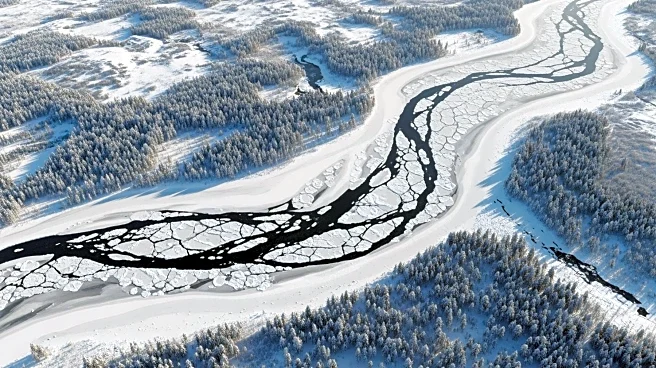
During a period of extreme cold in late January 2026, the Hudson River along Manhattan's western shore was observed to be choked with ice. This phenomenon was captured by the Operational Land Imager (OLI) on Landsat 8, which provided a detailed image
of the icy landscape. The image uses representational color to differentiate between ice, open water, and snow, with vegetation appearing in red. The ice likely originated from further upriver, where conditions are more conducive to freezing due to weaker tidal currents and lower salinity levels.
Why It's Important?
The presence of ice on the Hudson River highlights the impact of severe weather conditions on natural waterways. Such events can have significant implications for local ecosystems, transportation, and infrastructure. Understanding the formation and movement of river ice is crucial for managing potential risks associated with ice jams and flooding. The data collected by Landsat 8 provides valuable insights for scientists studying climate patterns and their effects on river systems. This information can aid in developing strategies to mitigate the impact of extreme weather on urban environments.