


What's Happening?
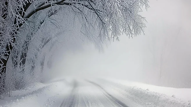
The National Weather Service (NWS) has issued a heavy snow warning for several states, including Wyoming, with forecasts predicting up to 18 inches of snow and winds reaching 90 mph. The affected areas include the Salt River and Wyoming Ranges, as well
as the Teton and Gros Ventre Mountains, and parts of Yellowstone National Park. The warning is in effect from Wednesday through Thursday evening, with the potential for travel to become 'impossible' in some regions. The NWS has also issued winter storm warnings and advisories for Montana, California, Nevada, Oregon, Washington, and Idaho. The storm is expected to bring subfreezing temperatures to parts of Utah, which could damage crops and outdoor plumbing.
Why It's Important?
This weather event is significant due to its potential to disrupt travel and daily life across a large portion of the western United States. The heavy snowfall and strong winds could lead to road closures, power outages, and infrastructure damage, affecting residents and businesses. The agricultural sector in Utah may face challenges due to the subfreezing temperatures, which could harm crops. The storm's impact on transportation could also affect supply chains and economic activities in the region. Emergency services and local governments may need to prepare for increased demand for assistance and resources.
What's Next?
As the storm progresses, residents in the affected areas are advised to stay informed through local news and weather updates. Authorities may implement road closures and travel advisories to ensure public safety. Emergency services are likely to be on high alert to respond to any incidents caused by the severe weather. Residents should prepare for potential power outages and ensure they have necessary supplies. The NWS will continue to monitor the situation and provide updates as needed.