


What's Happening?
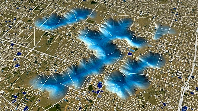
Mexico City is experiencing significant subsidence, sinking at a rate of up to 2 centimeters per month, as revealed by NASA's Nisar satellite. This phenomenon, primarily caused by excessive groundwater extraction, affects the city's infrastructure, including
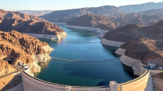
roads, buildings, and the metro system. The Nisar satellite, a joint project between NASA and the Indian Space Research Organisation, provides detailed radar imaging that tracks these changes in real-time. The data shows that areas like the city's main airport are among the most affected. The subsidence has been ongoing for over a century, with the city's soft soil, originally an ancient lake bed, compacting as water is withdrawn from the aquifer below.
Why It's Important?
The subsidence of Mexico City poses significant risks to its infrastructure and water supply. As the city continues to sink, the damage to roads, buildings, and water distribution systems could lead to severe economic and social challenges. The loss of water due to leaking pipes, exacerbated by the city's sinking, threatens the water supply for millions of residents. The Nisar satellite's data is crucial for understanding the extent of the problem and could inform future urban planning and water management strategies. The situation underscores the broader implications of groundwater depletion and the need for sustainable water management practices.
What's Next?
Addressing Mexico City's subsidence will require significant efforts to manage groundwater extraction and improve infrastructure resilience. The data from the Nisar satellite could guide policymakers in developing strategies to mitigate the impact of subsidence. However, halting the city's descent would necessitate reducing or stopping groundwater extraction, which poses a challenge given the city's reliance on this water source. Future steps may include exploring alternative water sources, enhancing water conservation efforts, and investing in infrastructure upgrades to withstand the ongoing subsidence.
Beyond the Headlines
The situation in Mexico City highlights the broader issue of urban areas built on soft soils and their vulnerability to subsidence. As cities worldwide face similar challenges, the data from the Nisar satellite could be instrumental in studying other regions at risk. The technology's ability to monitor changes in Earth's surface can also aid in understanding and mitigating the effects of natural disasters like earthquakes and landslides. This underscores the importance of integrating advanced technology into urban planning and disaster preparedness efforts.