



What's Happening?
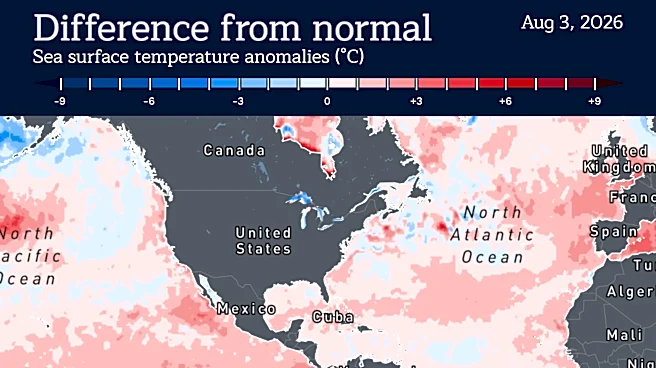
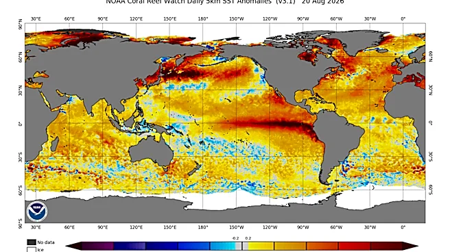
A strong El Niño event is currently underway, with the National Oceanic and Atmospheric Administration (NOAA) reporting its commencement on June 11. Forecasters predict a 90% chance of a very strong El Niño this winter, meaning equatorial Pacific surface
temperatures are 2 degrees Celsius warmer than average. Some scientists suggest this El Niño could reach historic levels. While El Niño has global impacts, its effects on Delaware are expected to be less pronounced compared to other U.S. regions. Sarah Johnson, a coordinating meteorologist for the National Weather Service in Mount Holly, New Jersey, noted that Delaware's winter weather is more influenced by the North Atlantic Oscillation than El Niño. However, a significant impact for Delaware is the suppression of tropical activity, with a 75% chance of a below-normal number of tropical storms. Historically, very strong El Niño events have shown varied impacts on Delaware, with past events in 2015-16 and 1997-98 resulting in different snow totals despite similar average temperatures and precipitation.
Why It's Important?
The forecast of a strong El Niño, even with limited direct impact on Delaware's winter, is important for regional planning and preparedness. The suppression of tropical storm activity in the Atlantic Basin is a notable benefit, potentially reducing the risk of coastal damage and flooding from hurricanes. However, the indirect effects of a strong El Niño on broader U.S. weather patterns could still have economic and social consequences for Delaware. For instance, if other regions experience severe weather, it could disrupt supply chains or impact national markets that affect Delaware's economy. The variability in past El Niño impacts on Delaware's snow totals highlights the complexity of localized weather forecasting and the influence of other climate patterns. This situation underscores the need for Delaware residents and authorities to remain informed about broader weather trends while understanding the specific factors that shape their local climate, ensuring appropriate resource allocation and emergency preparedness.
What's Next?
The National Weather Service has yet to issue its seasonal forecast for the upcoming winter, which will provide broader projections for temperatures and moisture. While snow totals are difficult to predict accurately due to multiple influencing factors, residents and businesses in Delaware should monitor these forecasts closely. The focus for Delaware will likely remain on the North Atlantic Oscillation for winter weather predictions, rather than solely on El Niño. However, the reduced tropical storm activity due to El Niño will continue to be a relevant factor for coastal communities during the remainder of the hurricane season. Long-term, understanding the interplay between global climate phenomena like El Niño and regional weather patterns is crucial for developing resilient infrastructure and adaptive strategies in the face of a changing climate.
Beyond the Headlines
The nuanced impact of El Niño on Delaware, where its influence is less direct compared to other U.S. regions, illustrates the complex and localized nature of climate effects. This highlights that global climate patterns do not uniformly affect all areas, and local geographical and atmospheric conditions play a critical role in mediating these impacts. The reliance on the North Atlantic Oscillation for Delaware's winter forecast underscores the importance of understanding multiple climate drivers. This situation also brings to light the challenge of communicating climate information effectively, as the public often seeks direct, simple answers to complex weather phenomena. For policymakers and urban planners, this means developing tailored strategies that consider both global climate trends and specific regional vulnerabilities, moving beyond a one-size-fits-all approach to climate resilience.