





What's Happening?
NASA Earth Observatory has released an image captured by the Moderate Resolution Imaging Spectroradiometer (MODIS) aboard the Terra satellite, showcasing a significant marine cloud inversion over the Pacific Northwest. On September 19, 2026, a vast blanket
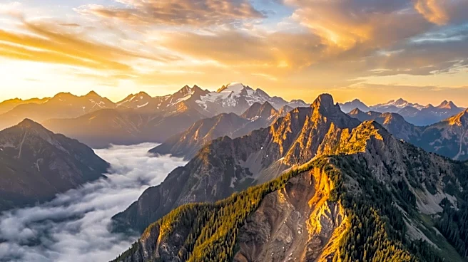
of low clouds covered much of western Washington and Oregon, extending from the Pacific coast towards the Cascade Range foothills. Only the highest elevations, such as peaks in Washington’s Olympic Mountains and parts of Oregon’s Coast Range, protruded through the cloud layer, appearing like islands in a white sea. This phenomenon occurred due to cool, moist marine air moving inland beneath warmer air higher in the atmosphere, creating a temperature inversion. This inversion acts as a lid, trapping the cooler, moist air near the surface, which then condenses into stratus clouds or fog when sufficiently cooled. The image, taken at approximately 10:45 a.m. Pacific Time, illustrates how topography significantly influences regional weather patterns, with mountains redirecting airflow and affecting cloud formation and penetration inland.
Why It's Important?
This natural phenomenon highlights the dynamic interplay between oceanic moisture, atmospheric temperatures, and geographical features in shaping regional weather. Temperature inversions, as observed, can lead to prolonged periods of fog and low clouds, impacting visibility for transportation, local climate, and even air quality by trapping pollutants closer to the ground. For residents, such conditions can mean muted, gray mornings, while from orbit, they present a dramatic visual spectacle. The ability of mountains to act as barriers or conduits for marine air masses is crucial for understanding local climate variations, influencing everything from agricultural practices to urban planning in coastal regions. The rapid dissipation of these cloud layers as the day progresses and land temperatures rise also underscores the daily rhythm of marine clouds and the swift changes in coastal weather, which are vital considerations for various sectors, including tourism and outdoor industries.
What's Next?
While this specific event is a past observation, the continuous monitoring of such weather patterns by agencies like NASA provides valuable data for meteorological forecasting and climate research. Future observations will likely continue to document similar inversions, contributing to a deeper understanding of atmospheric dynamics in the Pacific Northwest. Meteorologists will use this data to refine models that predict the formation and dissipation of marine stratus clouds and fog, improving short-term weather forecasts. This ongoing data collection also supports long-term climate studies, helping scientists assess how these patterns might shift with broader climate changes. The insights gained are crucial for industries dependent on weather predictability, such as aviation and shipping, and for communities needing to prepare for potential impacts of prolonged low visibility or altered local climates.
Beyond the Headlines
Beyond the immediate meteorological implications, the visual spectacle of mountains rising above a sea of clouds offers a unique perspective on Earth's natural beauty and the power of atmospheric processes. Such imagery can inspire public interest in Earth science and climate phenomena, fostering a greater appreciation for the complex systems that govern our planet's weather. From an environmental perspective, understanding temperature inversions is critical for managing air quality, as these conditions can trap pollutants, leading to health concerns in populated valleys. The study of these inversions also contributes to broader scientific efforts to model atmospheric behavior, which is essential for addressing challenges like climate change and its regional impacts. The contrast between ground-level experience and orbital views further emphasizes the multifaceted nature of scientific observation and the different scales at which environmental phenomena can be understood.