


What's Happening?
The Sitka Landslide Risk dashboard is providing real-time information on landslide hazard levels, rainfall forecasts, and efforts to monitor landslide impacts in Sitka, Alaska. The dashboard calculates hazard levels by comparing three-hour rainfall amounts,
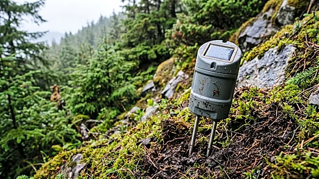
both observed and forecasted by the National Weather Service, with historical conditions that have led to landslides in the area. Research in Sitka indicates that rainfall measured over a three-hour interval is the most effective predictor of landslides, as the local soils drain rapidly, making short, intense bursts of rain a significant factor in hillside saturation and landslide occurrence. If moderate or high-risk levels are reached, these levels are maintained for six hours, as landslides often occur shortly after heavy rainfall. The project team and the U.S. Geological Survey have installed hydrologic sensor stations in the hills above Sitka to document changes in soil moisture and groundwater conditions in response to rainfall events. Additionally, citizen science 'tipping buckets' are deployed around town to provide real-time rain gauge data, which will help document local variations in hourly rainfall and improve NWS forecasts.
Why It's Important?
This initiative is crucial for public safety and community resilience in Sitka, a region prone to landslides. By providing real-time, data-driven risk assessments, the dashboard empowers residents and local authorities to make informed decisions, potentially saving lives and mitigating property damage. The reliance on three-hour rainfall intervals as a key predictor highlights the specific geological and hydrological characteristics of Sitka, offering a tailored approach to hazard prediction that is more effective than generalized models. The integration of National Weather Service forecasts with local sensor data and citizen science contributions represents a comprehensive and collaborative effort to enhance predictive accuracy. This model could serve as a blueprint for other U.S. communities facing similar geological hazards, demonstrating how localized research, advanced sensing technology, and community involvement can significantly improve disaster preparedness and response. The continuous monitoring and data collection also contribute to a deeper scientific understanding of landslide triggers, which is vital for long-term risk management strategies.
What's Next?
The Sitka Landslide Risk project aims for future enhancements, including the use of data from hydrologic sensor stations and citizen science tipping buckets to inform improved landslide forecasts. These data will help document how soil moisture and groundwater conditions change with rainfall and provide insights into local variations in hourly rainfall, ultimately refining the predictive models used by the National Weather Service. Community members are encouraged to support landslide science by reporting any observed landslides to landslides@sitkascience.org, which helps keep records current and forecasts calibrated. The ongoing collection of data and community engagement will be critical for the continuous improvement of the dashboard's accuracy and its effectiveness in alerting residents to potential dangers. The project's success could lead to the development of similar localized early warning systems in other U.S. regions susceptible to natural disasters, fostering a more proactive approach to hazard mitigation nationwide.
Beyond the Headlines
Beyond its immediate safety benefits, the Sitka Landslide Risk dashboard embodies a broader shift towards integrating advanced scientific research, technological innovation, and community participation in disaster preparedness. The project's emphasis on localized data and tailored predictive models underscores the limitations of one-size-fits-all approaches to natural hazards and highlights the importance of understanding specific environmental contexts. Ethically, providing accessible, real-time risk information empowers individuals with the knowledge to protect themselves and their families, fostering a sense of collective responsibility in disaster mitigation. Culturally, the involvement of citizen science initiatives can strengthen community bonds and increase public awareness of environmental risks, promoting a more resilient and informed populace. In the long term, the data collected from Sitka could contribute to national and international research on landslide dynamics, informing policy decisions and engineering practices aimed at reducing the impact of such events in vulnerable areas across the U.S. and globally.