





What's Happening?
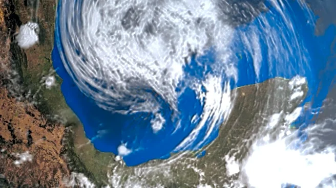
Texas is bracing for a significant flood threat this weekend, extending into Monday, as a strong trough of low pressure from Mexico draws abundant Gulf moisture into the state. This weather pattern is expected to bring heavy downpours, leading to a high
likelihood of flash flooding. Forecast models, including the ECMWF (Euro) model, indicate potential for high-end rainfall totals, with some areas south of San Antonio possibly receiving 6-10 inches of accumulation, and bullseyes of 9-12 inches in southern Texas not being ruled out. The Weather Prediction Center (WPC) has issued multiple excessive rain (flood) outlooks, with Sunday's outlook elevated to a Level 2 (slight) risk, signifying that scattered flash flooding is expected and a significant flood event is possible. Severe storms are also a possibility due to the low-pressure system providing ample wind shear.
Why It's Important?
The impending flood threat in Texas carries substantial risks for residents, infrastructure, and the state's economy. Flash flooding can rapidly inundate roads, homes, and businesses, leading to property damage, displacement, and potential loss of life. The high rainfall totals predicted could overwhelm drainage systems, causing widespread disruption and making travel hazardous. For individuals, the risk of losing important documents or suffering uninsured property damage is significant, especially if they reside in areas not typically considered flood-prone. For local authorities, managing such an event requires extensive coordination of emergency services, potential evacuations, and post-flood recovery efforts. The economic impact could be considerable, affecting local businesses and potentially disrupting supply chains. The repeated occurrence of such weather events also places a long-term strain on state and local budgets for infrastructure maintenance and disaster preparedness.
What's Next?
Residents in affected areas of Texas are advised to prepare for significant flash flooding. This includes securing important documents in dry locations, clearing gutters and drainage areas around properties, and verifying the status of flood insurance. The WPC's Level 2 (slight) risk for Sunday indicates that scattered flash flooding is expected, with a possibility of a significant flood event, and this outlook could be upgraded. This means that conditions could worsen, requiring continuous monitoring of weather updates and official advisories. Emergency services will likely be on high alert, and residents should be prepared for potential road closures and disruptions to daily life. The emphasis is on proactive measures to mitigate potential damage and ensure personal safety.
Beyond the Headlines
This flood threat underscores the broader challenges faced by regions susceptible to extreme weather, particularly those influenced by Gulf moisture. The increasing intensity and frequency of such events raise questions about the adequacy of current urban planning and infrastructure to handle future climate scenarios. It also highlights the critical role of accurate weather forecasting and public communication in minimizing casualties and property damage. Beyond the immediate impact, these events contribute to a growing national conversation about climate resilience, the need for updated flood maps, and the financial mechanisms required to support communities in adapting to and recovering from more frequent and severe weather patterns. The preparedness actions recommended, such as securing documents and checking insurance, reflect a growing individual responsibility in the face of systemic environmental changes.