
What's Happening?
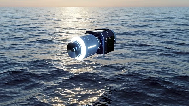
The Sentinel-6B satellite, part of a joint mission between NASA and European agencies, is set to launch to monitor sea levels and atmospheric conditions. The satellite will use radar altimetry to measure
ocean surface topography and record atmospheric temperature profiles. This data will improve weather forecasts, hurricane predictions, and studies of ocean tides. Sentinel-6B will continue the legacy of previous Jason-series missions, providing continuity in sea-level data collection.
Why It's Important?
Sentinel-6B's data is crucial for coastal planning and public safety. By providing accurate sea-level measurements, the satellite will help governments make informed decisions about infrastructure protection and real estate development. The mission supports commercial and recreational navigation by improving weather predictions. Additionally, the data will aid in safeguarding coastal military installations and energy sites, ensuring resilience against climate impacts.
What's Next?
After its launch, Sentinel-6B will map Earth's oceans every 10 days, delivering high-resolution data for weather prediction models. The satellite's measurements will inform local and state governments in their efforts to protect coastal areas. The mission will also contribute to scientific research on ocean circulation and climate phenomena, supporting global climate resilience initiatives.
Beyond the Headlines
The Sentinel-6B mission exemplifies the role of space technology in addressing environmental challenges. By extending the sea-level record, the satellite provides valuable insights into climate change effects. The collaboration between NASA and European partners highlights the importance of international efforts in tackling global issues. The mission underscores the need for continued investment in scientific research and technology development.