


What's Happening?
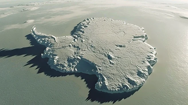
A team of researchers led by Helen Ockenden from the University of Edinburgh and the Institut des Geosciences de l'Environnement in France has developed a detailed map of Antarctica's subglacial topography using a modeling technique called Ice Flow Perturbation
Analysis (IFPA). This method utilizes satellite observations of the ice surface and the physics of ice flow to infer the landscape beneath the ice, which is located up to 3 miles below the surface. The new map reveals previously unknown geological features, such as steep-sided channels and deep valleys, which could provide insights into the ancient, pre-glacial Antarctica. This advancement is crucial for understanding ice movement and predicting potential contributions to global sea-level rise.
Why It's Important?
The detailed mapping of Antarctica's subglacial topography is significant for predicting ice loss and its impact on global sea levels. As climate change continues to affect polar ice caps, understanding the underlying topography is essential for accurate modeling of ice flow and melt rates. This research could inform future geophysical surveys and guide international efforts to study ice sheet dynamics. The findings have implications for global climate models and could influence policy decisions related to climate change mitigation and adaptation strategies.
What's Next?
The upcoming International Polar Year 2031-2033 presents an opportunity for international collaboration to further study Antarctica's ice sheet and bedrock properties. Researchers plan to integrate expansive observation and modeling approaches to enhance understanding of ice dynamics. Future surveys will aim to capture finer details of the subglacial landscape, which could lead to more precise predictions of ice behavior and sea-level changes.