







What's Happening?
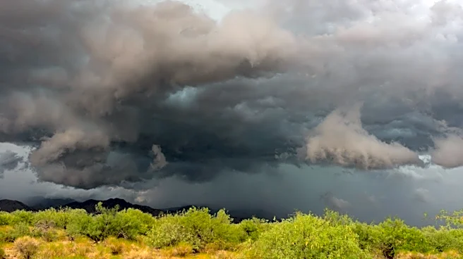
The Phoenix area is preparing for two distinct waves of potentially heavy precipitation this weekend, leading to a Flash Flood Watch for metro Phoenix and much of Arizona. The first wave is expected to arrive Friday morning and continue through the day,
bringing showers, thunderstorms, and locally heavy rain. While not anticipating the severe weather seen last week, there is a focus on the chance for flash flooding. Friday night into Saturday afternoon is projected to be relatively quiet between storm systems. However, the second wave of rain could begin as early as Halloween night (Saturday), with heavier precipitation expected to increase during the nighttime hours and last through much of Sunday. Sunday is currently forecast to be a more significant rain day than Friday, with scattered showers and embedded thunderstorms across the entire state. High temperatures for the weekend will generally be in the 70s, potentially dropping into the 60s on Sunday afternoon. The Valley could see 1-2 inches of rain through Sunday.
Why It's Important?
The forecast for significant rainfall and flash flooding in Phoenix and across Arizona carries substantial importance for public safety, infrastructure, and daily life. Flash floods can quickly inundate roads, underpasses, and low-lying areas, creating hazardous driving conditions and potentially isolating communities. This poses a direct threat to residents, particularly those in areas prone to flooding. The disruption to transportation can impact commerce and emergency response efforts. For businesses, especially those in retail or hospitality, the weekend weather could deter customers and affect revenue, particularly with Halloween activities planned for Saturday. The agricultural sector, while potentially benefiting from increased moisture, also faces risks of erosion and damage to crops from excessive rainfall. The strain on local emergency services will be considerable, requiring coordinated efforts to manage potential rescues and mitigate flood impacts. The cumulative effect of these storms could lead to significant economic costs for recovery and repairs.
What's Next?
Residents in the Phoenix area and across Arizona are urged to stay informed about weather alerts and follow safety guidelines, especially concerning flash flooding. The Flash Flood Watch indicates a high potential for dangerous conditions, and authorities will likely issue specific warnings and advisories as the storms progress. For Halloween on Saturday, trick-or-treaters should be aware that while the early part of the evening might be dry, rain is expected to move in later, potentially impacting outdoor plans. The heaviest rainfall is anticipated on Sunday, making it crucial for individuals to avoid flooded roads and areas. Emergency management agencies will be monitoring river levels and urban drainage systems to prevent and respond to flooding. Drier weather is expected to return by Monday, allowing for initial assessments of any damage and the beginning of recovery efforts.
Beyond the Headlines
The repeated occurrence of significant storm systems in Arizona, an arid region, prompts a deeper look into the long-term implications of changing weather patterns. While individual events are part of natural variability, a trend towards more intense rainfall events could challenge existing infrastructure designed for different climatic conditions. This raises questions about the adequacy of current stormwater management systems and the need for future investments in resilient infrastructure. Culturally, such events can impact community traditions and outdoor activities, requiring adaptation and flexibility. From an environmental perspective, while rain is vital for desert ecosystems, sudden heavy downpours can lead to significant erosion and alter natural habitats. The ongoing need for public education on flood safety and preparedness remains paramount, fostering a culture of resilience in the face of evolving weather challenges.