


What's Happening?
San Antonio and the surrounding Hill Country are preparing for the first widespread sunrise temperatures in the upper 40s and lower 40s, respectively, for Tuesday and Wednesday. The National Weather Service reports that a cold air mass, which moved into
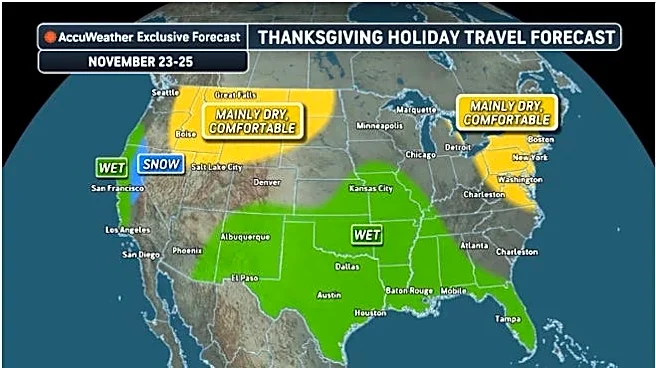
the region at the start of the week, is responsible for this significant drop in temperatures. While highs in San Antonio are expected to reach the 60s on Tuesday and Wednesday, a warming trend is anticipated to begin on Thursday, with temperatures climbing into the lower 70s. This trend is projected to continue until at least the early part of the weekend, when a weak cold front might bring showers to up to half of the region on Saturday night, though this forecast is subject to change. The long-range forecast for Thanksgiving week suggests highs in the 60s and lows in the 40s, but with less certainty.
Why It's Important?
The arrival of widespread colder temperatures marks a seasonal shift for residents in San Antonio and the Hill Country, impacting daily routines, particularly morning commutes for work and school. This weather pattern is significant for local agriculture and outdoor activities, as it signals the end of warmer seasons. From an environmental perspective, the report notes that San Antonio has received nearly 34 inches of rain year-to-date, about four inches more than a typical year, significantly improving drought conditions. The northern half of the county is now drought-free, and the southern half, while still abnormally dry, has also seen improvement. This improved rainfall has allowed county commissioners to lift a ban on outdoor burning, and aerial fireworks are likely to be permitted for Christmas and New Year's Day in unincorporated areas, indicating a positive shift in local environmental conditions.
What's Next?
Residents are advised to bundle up for morning commutes on Tuesday and Wednesday due to the chilly temperatures. The National Weather Service will continue to monitor the weather patterns, especially for the potential weak cold front and associated showers expected late in the week. The long-range forecast for Thanksgiving week will be updated as more certainty becomes available. The improved drought conditions, while positive, will require continued monitoring, as a dry spell could quickly reverse the progress. The lifting of the outdoor burning ban and the likely allowance of aerial fireworks for the holidays will impact local regulations and public safety advisories in the coming weeks.
Beyond the Headlines
The shift to colder weather and improved drought conditions in the San Antonio area have broader implications beyond immediate comfort. The replenished Edwards Aquifer, a critical water source for over 2 million people, is a significant environmental and economic boon, though it remains below historical levels for this time of year. This improvement in water resources can positively affect local ecosystems, agricultural output, and long-term water security for the region. The ability to lift outdoor burning bans and allow fireworks for holidays also reflects a return to more normal community activities, which can have a positive psychological impact after periods of drought-induced restrictions. This highlights the interconnectedness of weather patterns, environmental health, and community well-being.