


What's Happening?
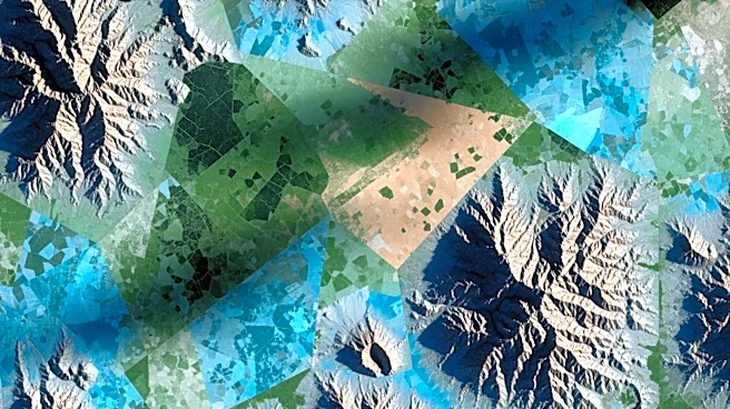
NASA's Earth Observatory has released its June 2026 satellite image puzzle, inviting the public to identify the location shown in the image. This monthly challenge encourages participants to analyze satellite imagery and share their insights on the location,
satellite, and instruments used. Participants are also encouraged to discuss any unique geological or historical aspects of the area. While there are no monetary prizes, successful participants gain 'puzzler bragging rights' and may be featured on NASA's website. The challenge aims to engage the public in Earth science and satellite technology.
Why It's Important?
This initiative by NASA serves to increase public engagement and awareness of Earth science and satellite technology. By involving the public in identifying satellite images, NASA fosters a greater understanding of how satellite data is used to monitor and study Earth's environment. This engagement can inspire interest in STEM fields and promote educational opportunities. Additionally, it highlights the importance of satellite technology in understanding global phenomena, such as climate change and natural disasters, which have significant implications for policy and decision-making.
What's Next?
Participants have a week to submit their responses, after which NASA will reveal the correct answer and provide additional context about the image. This ongoing series of challenges will continue to engage the public, with future puzzles likely to feature different locations and themes. As public interest grows, NASA may expand its outreach efforts, potentially incorporating more interactive and educational elements into the program. This could include virtual workshops or collaborations with educational institutions to further promote Earth science literacy.