


What's Happening?
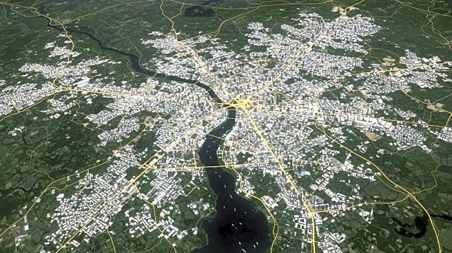
NASA's Landsat program is playing a crucial role in urban development planning by capturing patterns of urban growth. Landsat data enables city planners to monitor the impacts of land use change and plan future development. With nearly 60 percent of the world's
population living in urban areas, Landsat's sensors provide valuable insights into urban sprawl, land use efficiency, and the heat island effect. The program's spatial resolution allows for detailed observation of human impacts on the land, helping researchers create land-use maps and assess the impact of urbanized land on energy, water, and carbon balances.
Why It's Important?
The use of Landsat data in urban planning is significant as it provides city planners and decision-makers with critical information to manage urban growth sustainably. By monitoring urban sprawl and land use efficiency, Landsat helps mitigate environmental impacts such as pollution and heat island effects. The data supports efforts to improve urban infrastructure, reduce energy consumption, and enhance the quality of life for urban residents. As cities continue to expand, Landsat's insights are essential for developing strategies that balance growth with environmental preservation.