
What's Happening?
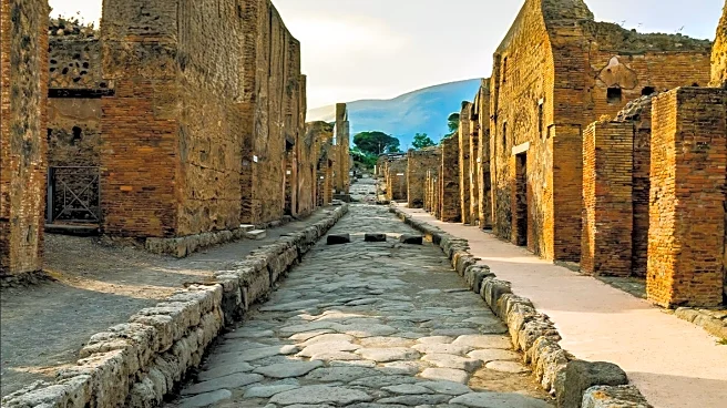
A team of international researchers has developed a new visualization tool called Itiner-e, which serves as a digital map of ancient Roman roads across Europe, the Near East, and North Africa. This interactive
map, described as the 'Google Maps for Roman roads,' is based on 200 years of research and spans over 300,000 kilometers of the Roman Empire's transportation network. The tool allows users to virtually explore how Romans transported goods, people, and military equipment using chariots and carriages pulled by horses. The researchers aim to provide a comprehensive understanding of the Roman road network, facilitating insights into how people, ideas, and infectious diseases spread 2,000 years ago.
Why It's Important?
The development of Itiner-e is significant as it offers a detailed visualization of the Roman Empire's extensive road network, which played a crucial role in its expansion and administration. By providing a clearer picture of ancient transportation systems, the tool enhances historical knowledge and aids in understanding the movement of goods, people, and ideas during that era. This can lead to a better appreciation of the Roman Empire's influence on modern infrastructure and cultural exchange. Additionally, the tool's ability to illustrate the spread of infectious diseases in ancient times may offer valuable insights for contemporary public health studies.
What's Next?
The researchers plan to continue expanding the Itiner-e tool by incorporating additional data and research findings to refine the accuracy of the Roman road network map. As more information is added, the tool is expected to become an even more valuable resource for historians, archaeologists, and educators. The ongoing development of Itiner-e may also inspire similar projects aimed at visualizing other historical transportation networks, further enriching the field of historical research and education.
Beyond the Headlines
The creation of Itiner-e highlights the intersection of technology and historical research, demonstrating how digital tools can transform the study of ancient civilizations. This project underscores the importance of interdisciplinary collaboration, combining archaeology, history, and technology to produce innovative educational resources. The tool's ability to visualize the spread of ideas and diseases also raises ethical considerations regarding the interpretation and representation of historical data, prompting discussions on the accuracy and reliability of digital reconstructions.