


What's Happening?
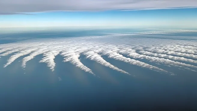
The National Oceanic and Atmospheric Administration (NOAA) has released a striking image of 'cloud streets' forming off the coast of Florida. These cloud formations occur when cold air moves over warmer waters, creating parallel lines of clouds that align
with prevailing winds. The phenomenon was observed as Florida experienced unusually cold temperatures, with Tampa reporting lows of 30 degrees Fahrenheit. The image was captured by the Advanced Baseline Imager on NOAA's GOES-19 weather satellite, which monitors weather patterns and environmental conditions from a geostationary orbit.
Why It's Important?
The occurrence of 'cloud streets' highlights the dynamic interactions between atmospheric conditions and oceanic temperatures. Such phenomena are not only visually captivating but also provide valuable data for meteorologists studying weather patterns and climate change. Understanding these interactions is crucial for predicting weather events and assessing their potential impacts on local environments and economies. The data collected by satellites like GOES-19 is essential for improving weather forecasts and preparing for extreme weather conditions, which can have significant implications for public safety and infrastructure planning.
What's Next?
As climate patterns continue to evolve, the monitoring of atmospheric phenomena like 'cloud streets' will remain important for understanding broader environmental changes. NOAA and other meteorological agencies will likely continue to leverage satellite technology to track weather patterns and provide timely information to the public. This data can inform policy decisions related to climate adaptation and resilience, particularly in regions vulnerable to extreme weather events. Continued research and observation will be key to enhancing predictive models and developing strategies to mitigate the impacts of climate variability.