


What is the story about?
What's Happening?
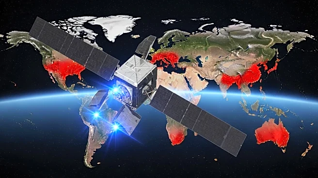
NASA has integrated the Visible Infrared Imaging Radiometer Suite (VIIRS) global burned area product into its Fire Information for Resource Management System (FIRMS). This addition aims to provide continuity to the existing Moderate Resolution Imaging Spectroradiometer (MODIS)-generated burned area product. The VIIRS product, known as VNP64A1, utilizes a similar algorithm to the MODIS MCD64A1 Collection 6.1, maintaining a 500-meter resolution on a sinusoidal grid. The VIIRS product is compiled and distributed monthly, characterizing burned areas by detecting changes in surface reflectance imagery, such as charcoal deposits and vegetation removal. The product requires a continuous month of daily surface reflectance imagery and active fire detection data, resulting in a five-month lag before availability. The VIIRS product has been available since March 2012, following the launch of the Suomi NPP satellite. Users can access the product through FIRMS' ADVANCED MODE and BURNED AREA mode, allowing for simultaneous display and comparison of monthly burned area products.
Why It's Important?
The integration of the VIIRS global burned area product into FIRMS is significant for enhancing fire monitoring capabilities. By providing continuity to the MODIS product, NASA ensures that researchers and resource managers have access to consistent and reliable data for tracking and analyzing fire impacts. This is crucial for understanding the ecological and environmental consequences of fires, such as changes in vegetation structure and carbon emissions. The ability to compare monthly and annual datasets allows for more comprehensive analysis and decision-making in fire management and mitigation strategies. The VIIRS product's availability since 2012 expands the historical dataset, offering insights into long-term fire trends and patterns, which are essential for developing effective policies and practices to address fire-related challenges.
What's Next?
NASA plans to develop a combined burned area product based on observations from VIIRS aboard both the Suomi NPP and NOAA-20 satellites. This future enhancement aims to improve the accuracy and coverage of burned area data, providing users with more detailed information for fire management. As the integration progresses, stakeholders such as environmental agencies, researchers, and policymakers are likely to utilize the enhanced data for better understanding fire dynamics and implementing more effective fire prevention and response strategies. The continued development and refinement of fire monitoring products will play a critical role in addressing the increasing frequency and intensity of wildfires globally.
Beyond the Headlines
The integration of VIIRS into FIRMS highlights the importance of satellite technology in environmental monitoring and management. The ability to detect and analyze burned areas from space offers a unique perspective on the impact of fires on ecosystems and human communities. This development also underscores the role of international collaboration in advancing scientific research, as the VIIRS instrument is a joint effort between NASA and NOAA. The ongoing enhancement of fire monitoring systems reflects a broader trend towards leveraging technology for sustainable resource management and climate resilience.