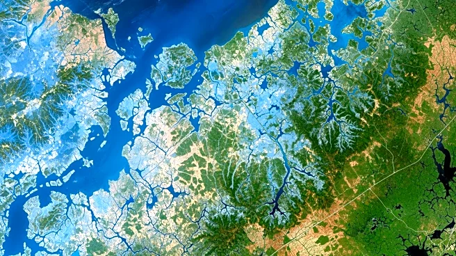


What's Happening?
NASA's Earth Observatory has released its March 2026 satellite image puzzle, inviting the public to identify the location depicted in the image. Participants are encouraged to share their observations and guesses about the location, as well as any interesting
details about the geology or history of the area. The challenge is designed to engage the public in Earth science and satellite imagery interpretation. While there are no monetary prizes, participants can earn 'puzzler bragging rights' and may be featured in NASA's follow-up post if they provide particularly insightful or correct answers.
Why It's Important?
This initiative by NASA serves to increase public engagement with Earth science and satellite technology. By encouraging individuals to analyze and interpret satellite images, NASA fosters a greater understanding of Earth's geography and the role of satellite technology in monitoring environmental changes. This can lead to increased public interest in science and technology fields, potentially inspiring future generations of scientists and researchers. Additionally, the challenge highlights the accessibility of satellite data and its applications in understanding our planet.