


What's Happening?
The Surface Water and Ocean Topography (SWOT) satellite, a joint project between NASA and the French space agency CNES, has provided groundbreaking data on the world's river systems. Launched in December 2022, SWOT has been operationally collecting data to
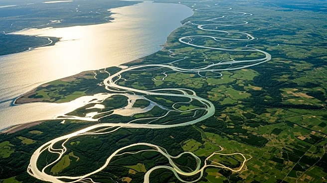
map river channels and measure water volumes. The satellite's recent analysis covered 127,000 river segments globally, revealing significant variations in river volumes, particularly in the Amazon River, which experienced fluctuations of over 45 trillion gallons. This data is crucial for understanding river dynamics, especially in remote areas where traditional measurement methods are challenging. The SWOT satellite's advanced instruments, including the KaRIn instrument and a two-beam microwave radiometer, have enabled these detailed observations.
Why It's Important?
The data provided by SWOT is vital for multiple sectors, including environmental management, shipping, and flood prediction. By offering a detailed view of river dynamics, the satellite helps address longstanding questions about river flow rates and the impact of rainfall and snowmelt. This information is essential for managing water resources, predicting floods, and understanding the global water cycle. The insights gained can influence policy decisions and infrastructure planning, particularly in regions prone to flooding or drought. Additionally, the data can aid in climate change research by providing a clearer picture of how water systems are responding to environmental changes.
What's Next?
As SWOT continues its operations, further data collection will enhance the understanding of river systems and their responses to environmental changes. Researchers will likely focus on integrating this data into models for better flood prediction and water resource management. The satellite's findings could prompt governments and organizations to reassess water management strategies and infrastructure investments. Continued collaboration between NASA, CNES, and other international partners will be crucial in expanding the satellite's capabilities and applications.
Beyond the Headlines
The SWOT satellite's ability to map river channels and measure water volumes has implications beyond hydrology. It can influence global shipping routes by providing detailed maps of riverbeds and banks, which are critical for navigation. The data can also contribute to ecological studies by offering insights into habitats dependent on river systems. Furthermore, the satellite's findings may lead to advancements in satellite technology and remote sensing, enhancing future environmental monitoring capabilities.