


What's Happening?
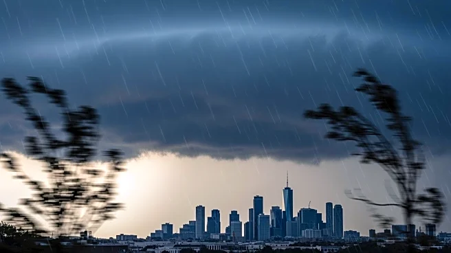
An intensifying low-pressure system is delivering a wet and windy Thursday to the New York City area. Light rain has already slowed down the morning commute, but heavier downpours, thunder, and lightning are expected to impact the afternoon and evening
commuters. The storm is predicted to be most intense from mid-afternoon through early evening before moving out of the area, leading to drier skies overnight. Rainfall is expected to be between one to three inches across most of the area, which is spread throughout the day, reducing the likelihood of flash flooding. However, ponding and minor roadway flooding could lead to hazardous driving conditions. Strong east winds are also forecasted, with gusts reaching 30 to 40 miles per hour inland and up to 50 miles per hour along the coast. Minor coastal flooding is anticipated at high tide in low-lying areas.
Why It's Important?
The storm's impact on the NYC area is significant due to the potential for hazardous driving conditions and minor coastal flooding, which could disrupt daily activities and transportation. The timing of the storm coincides with Halloween preparations, raising concerns about whether conditions will clear in time for festivities. The strong winds and heavy rain could affect outdoor events and travel plans, prompting residents and local authorities to prepare for potential disruptions. The storm's movement and intensity are being closely monitored to ensure public safety and minimize inconvenience.
What's Next?
The storm is expected to pull away from the region by Thursday night, leaving strong westerly winds in its wake. This change in weather conditions is expected to guarantee a dry day and evening for Halloween festivities, allowing for outdoor activities to proceed as planned. Residents and event organizers are advised to stay updated on weather forecasts and prepare for any last-minute changes in conditions.