
What's Happening?
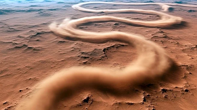
Researchers have utilized the Colour and Stereo Surface Imaging System (CaSSIS) on the European Space Agency's ExoMars Trace Gas Orbiter to catalog 1,039 Martian dust devils. This effort has resulted in the first global map of Mars' surface winds. The imaging process captures slight delays between different channels, creating color offsets in the final images when dust devils move, allowing scientists to measure their speed and distance traveled. This method has reshaped the understanding of Mars' climate and provided crucial data for future missions.
Why It's Important?
The findings from this study are significant as they provide a comprehensive view of Martian weather patterns, which are crucial for planning future robotic and human missions. Understanding the wind and dust activity on Mars can help in selecting safe landing sites and predicting dust accumulation on solar panels of rovers. The data also enhances climate models, offering better forecasts of Mars' weather, which is essential for mission planning and execution.
What's Next?
The catalog of dust devils is a public resource, continuously updated with new images. This data will aid in planning the 2030 landing of the ExoMars Rosalind Franklin rover, ensuring it avoids the global dust storm season. Researchers will continue to analyze the data to refine climate models and improve predictions of wind patterns on Mars.
Beyond the Headlines
The study highlights the innovative use of existing technology to gather new insights. By turning what was once considered digital noise into valuable data, researchers have opened new avenues for understanding Martian climate. This approach underscores the potential for re-evaluating existing data with fresh perspectives to uncover hidden information.