


What's Happening?
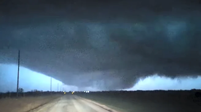
North Texas is bracing for another round of severe weather as a cold front approaches the region. The Storm Prediction Center has issued a level 2 out of 5 risk for severe storms, with the main threats being large hail and damaging winds. An isolated
tornado is also possible. Rainfall is expected to total 1-2 inches, with localized areas receiving over 3 inches. The strongest storms are anticipated before 11 a.m., with continued activity southeast of DFW until 2 p.m. Temperatures will drop throughout the day, with wind gusts reaching up to 25 mph. Sunday is forecasted to be sunny and dry, with a high of 72 degrees.
Why It's Important?
The severe weather poses significant risks to residents and infrastructure in North Texas. Large hail and damaging winds can cause property damage, while heavy rainfall increases the risk of flash flooding, potentially disrupting transportation and daily activities. The possibility of an isolated tornado adds to the urgency for residents to stay informed and prepared. This weather event underscores the importance of effective communication and emergency preparedness in mitigating the impact of natural disasters.
What's Next?
Following the weekend storms, North Texas may experience isolated non-severe storms on Monday. However, another round of severe weather is expected on Tuesday and Wednesday, with a slight risk due to an upper-level low and surface front. A First Alert Weather Day has been declared for these days, highlighting the potential for hail, damaging winds, flooding, and isolated tornadoes. Residents are advised to stay updated on weather forecasts and take necessary precautions.