
What's Happening?
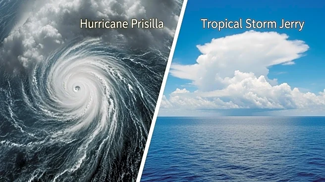
Hurricane Priscilla, currently a Category 1 storm, is moving along Mexico's Pacific coast, bringing potential heavy rainfall and flash flooding. Meanwhile, Tropical Storm Jerry in the Atlantic is expected to strengthen into a hurricane, posing a threat to the northern Leeward Islands. Jerry's rapid movement is preventing immediate intensification, but it is forecasted to slow down and become a hurricane by Thursday. The U.S. National Hurricane Center has issued tropical storm watches for several islands, anticipating rain and wind impacts. Priscilla is expected to weaken further, while Tropical Storm Octave in the Pacific is dissipating.
Why It's Important?
The development of these storms highlights the ongoing challenges posed by extreme weather events, which can lead to significant disruptions in affected regions. The potential for heavy rainfall and flooding in Mexico and the Leeward Islands underscores the need for preparedness and effective response strategies. These storms also illustrate the broader impacts of climate change on weather patterns, emphasizing the importance of monitoring and adapting to increasingly volatile conditions. The economic and social implications for affected areas, including potential damage to infrastructure and displacement of communities, are significant.
What's Next?
As Hurricane Priscilla continues to weaken, attention will shift to Tropical Storm Jerry's progression and its potential impact on the Leeward Islands. Authorities in affected regions are likely to enhance preparedness measures and issue warnings to residents. The U.S. National Hurricane Center will continue to monitor the storms and provide updates on their trajectories and intensities. The broader implications for climate policy and disaster management may prompt discussions on improving resilience and adaptation strategies in vulnerable areas.