


What's Happening?
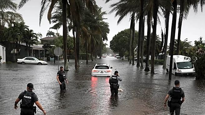
The National Weather Service has issued a warning for South Florida, where slow-moving thunderstorms are expected to bring heavy downpours, potentially causing localized flooding. The storms are predicted to develop in the afternoon, with the strongest
ones bringing gusty winds and significant rainfall. Urban areas and regions with poor drainage are particularly at risk. Despite the storms, temperatures will remain high, with heat index values ranging from 103 to 108 degrees. Miami is forecasted to reach a high of 92 degrees, while Fort Lauderdale and West Palm Beach are expected to see highs of 91 degrees. Residents are advised to stay hydrated, wear lightweight clothing, and limit strenuous outdoor activities during peak heat hours.
Why It's Important?
The weather conditions pose a significant risk to public safety and infrastructure in South Florida. Localized flooding can disrupt transportation, damage property, and pose health risks, particularly in areas with inadequate drainage systems. The high temperatures, combined with humidity, increase the risk of heat-related illnesses, making it crucial for residents to take precautions. The situation underscores the importance of effective urban planning and emergency preparedness in regions prone to extreme weather events. The economic impact could also be substantial, affecting businesses and tourism in the area.
What's Next?
Residents and local authorities will need to monitor weather updates closely and prepare for potential flooding. Emergency services may be on standby to respond to any incidents resulting from the storms. The National Weather Service will continue to provide updates and advisories as the situation develops. Long-term, this event may prompt discussions on improving infrastructure resilience and emergency response strategies in South Florida.