


What's Happening?
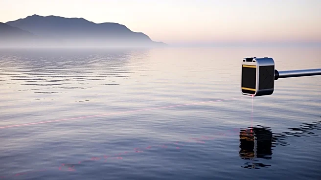
NASA's Advanced Topographic Laser Altimeter System (ATLAS), part of the ICESat-2 satellite, is providing precise bathymetric data for coastal and marine applications. The lidar instrument sends 10,000 pulses of light per second, offering detailed depth
mapping that supports safe navigation and marine science management. The ATLAS instrument can measure depths up to 40 meters in clear water, aiding shipping and navigation organizations. NASA's Applied Remote Sensing Training program (ARSET) is hosting a two-part online training session on December 2 and 4, 2025, to educate users on accessing and analyzing ICESat-2 bathymetry data.
Why It's Important?
The data provided by ICESat-2's ATLAS instrument is crucial for enhancing safety and efficiency in marine navigation. Accurate depth mapping is essential for preventing maritime accidents and optimizing shipping routes. The training offered by NASA will empower remote sensing scientists, geospatial analysts, and organizations to utilize this data effectively, potentially leading to advancements in coastal management and marine research. This initiative reflects NASA's commitment to leveraging satellite technology for practical applications that benefit public and private sectors.
What's Next?
The upcoming ARSET training will expand the knowledge base of participants, enabling them to apply ICESat-2 data in various fields. As more organizations adopt this technology, there could be increased collaboration between scientific communities and maritime industries. The ongoing migration of NASA Earth science data to the Earthdata platform will further streamline access to these resources, enhancing their utility for global stakeholders.
Beyond the Headlines
The use of satellite-derived bathymetry represents a significant advancement in remote sensing technology, offering a non-invasive method to study coastal environments. This approach could lead to more sustainable marine practices and improved environmental monitoring, aligning with global efforts to protect marine ecosystems.